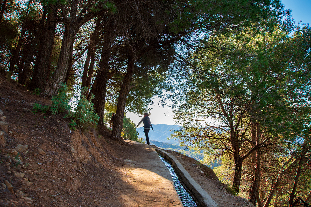
On several of our walks in the Axarquía, we follow acequias as they wind their way around the mountainsides. At first glance, there isn't much to them: a narrow channel, sometimes stone, sometimes concrete, carrying a steady flow of water.
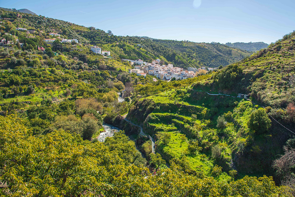
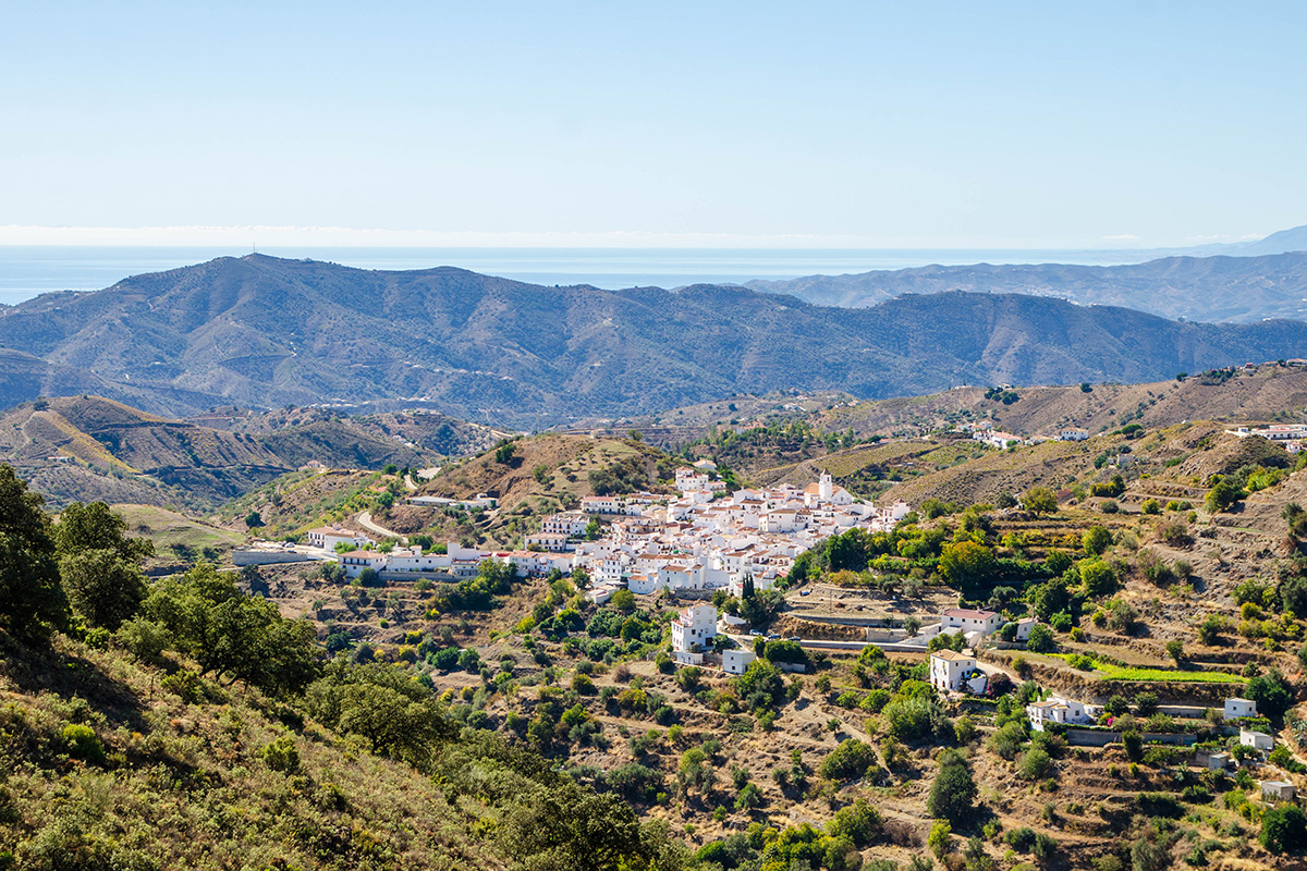
But stop beside one and look downhill. Below you might be terraces cut into the hillside, avocado and citrus trees, old farmhouses and cultivated plots. Further away, perhaps one of the white villages sitting on a ridge or spreading across the slopes. Suddenly, that little channel of water begins to look rather more important.
For centuries, one of the great challenges of living and farming in this part of Andalucía has been getting water to where it is needed. There may be a river flowing through the valley below, but that isn't much help if your fields and orchards are hundreds of metres above it.
The solution was beautifully simple. Take water from a river or spring higher in the mountains and carry it around the contours of the hillside, allowing gravity to do the work. These channels are known as acequias, a word derived from Arabic, and they became fundamental to the agricultural landscapes developed during Al Andalus.
Together with terraces, storage pools and an organised system for sharing water, they allowed communities to cultivate land that would otherwise have been extraordinarily difficult to farm. Once you understand that, an acequia stops being just a channel beside the path. It becomes part of the explanation for the landscape around you.
Making Water Travel Across a Mountain
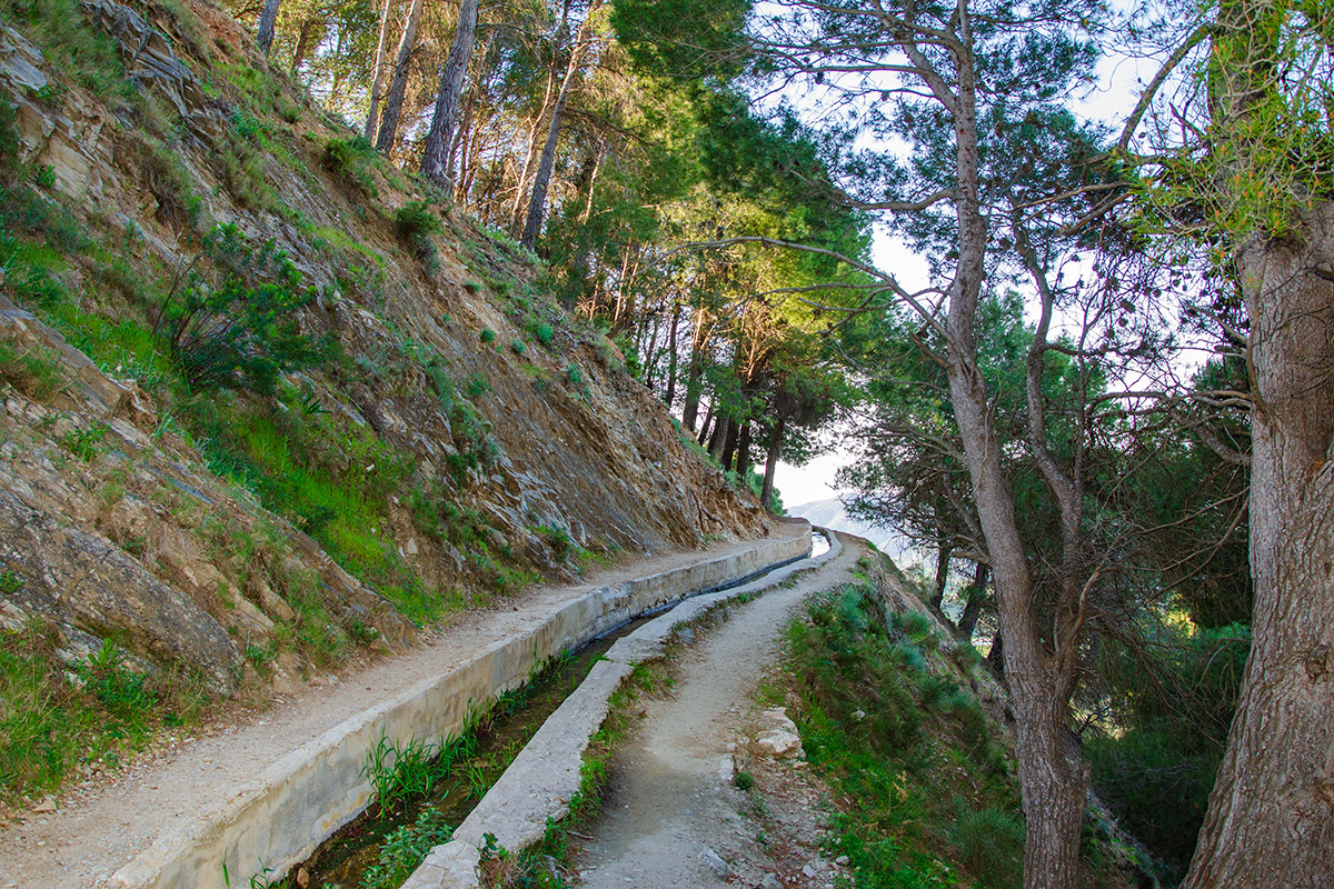
The basic principle behind an acequia is surprisingly simple. Water is taken from a river or spring at a high point and carried across the mountainside in a channel with a very gentle downward gradient. Gravity keeps the water moving, but because the channel loses height so slowly, it can travel a considerable distance while remaining well above the river valley.
Instead of trying to lift water from a river far below, the builders captured it further upstream, while it was still high enough to reach the land they wanted to cultivate. In effect, they created an artificial river and persuaded it to follow the contours of the mountain.
Simple in principle doesn't necessarily mean simple to build. The gradient had to be carefully judged. Too steep and fast-flowing water could damage the channel; too shallow and the water might flow poorly or stop altogether. All of this had to be achieved while crossing steep hillsides and negotiating ravines over considerable distances.
When you walk beside an acequia, the channel itself can look remarkably ordinary, but follow its course with your eye and you begin to appreciate just how carefully it has been positioned within the landscape.
More Than an Irrigation Channel
An acequia rarely worked alone. Water might first be diverted from a river by a small weir, known as an azud, before entering the main channel. From there, smaller channels could distribute it across cultivated land, while albercas, or storage pools, held water until it was needed.
Together, these created a network linking the water source with terraces, orchards and other cultivated plots. In some places, the same water could also be used to power mills before continuing on its journey. What appears to be a simple irrigation channel was actually one part of a much larger system for capturing, storing and using water.
Irrigation itself wasn't new to Spain. The Romans and earlier communities had already developed ways of managing and moving water. What changed during Al Andalus, from the eighth century onwards, was the extent to which irrigated agriculture was developed and organised, particularly in dry Mediterranean and mountainous landscapes.
The inhabitants of Al Andalus didn't invent irrigation in Spain, but they greatly expanded and refined its use. Acequias, terraces and storage pools became closely connected, allowing water to support agriculture across landscapes where farming would otherwise have been much more limited.
Water Changed the Landscape
Bringing water across the mountainside changed what could be grown there. Much of the Axarquía is steep, and without a reliable supply of water through the long, dry summer, many hillsides would have been far more difficult to cultivate.
Acequias worked alongside another familiar feature of the landscape: terraces. Stone walls created areas of flatter ground on steep slopes, while the channels brought water to them. Together, they allowed orchards and other crops to be grown in places that might otherwise have remained marginal farmland.
Over generations, the effect went much further. Irrigated land supported farms and communities, paths developed between cultivated areas, and settlements became closely connected to the availability of water. In some places, the irrigation network, agricultural land and settlement effectively developed together.
It's easy when walking through the Axarquía to see the terraces, orchards and white villages simply as part of a beautiful landscape. But much of what we are looking at has been shaped by centuries of human intervention. The acequia didn't merely carry water through that landscape. It helped create it.
Sharing Something Precious
Getting water across the mountainside was only part of the challenge. Once it arrived, communities had to decide who could use it, when and for how long. Water was limited, particularly during the dry summer months, and taking too much upstream could leave farmers further along the system with too little.
Rules therefore developed around its distribution. Farmers might receive access at particular times, while responsibility for keeping the channels clear and repairing damage also had to be shared. An acequia blocked by vegetation, silt or a collapsed section was a problem for everyone who depended on it downstream.
This communal organisation was just as important as the physical channel. The legacy of Al Andalus wasn't simply a network of acequias, terraces and storage pools, but also ways of managing a scarce resource between the people who depended upon it.
Many of these irrigation systems continued to be used long after Islamic rule ended, and traditions of collectively managing and maintaining water survived with them. The people changed, channels were repaired and rebuilt, but the need to share the water remained.
An Axarquía Shaped by Water
The Axarquía provides a particularly clear example of how all these elements came together. Mountains rise steeply behind the Mediterranean coast, rivers run through deep valleys, and many villages and cultivated areas sit high above the natural watercourses. It is a landscape where managing water became fundamental to making difficult terrain productive.
You can see that relationship around villages such as Frigiliana, Cómpeta, Árchez, Canillas de Albaida and Canillas de Aceituno. Their surrounding hillsides contain terraces, old agricultural plots, paths and water systems reflecting centuries of people adapting the land for cultivation.
Cómpeta gives us an especially interesting glimpse into that past. After the Morisco population was removed, a repartimiento from 1575 recorded the redistribution of land around the village. Historians have used these records to reconstruct aspects of the agricultural landscape left behind, providing documentary evidence of the terraces, cultivated land and rural organisation associated with the Morisco community.
The old terraces and water channels we walk beside today aren't simply features that happen to surround the white villages. They're part of an agricultural landscape that helped those communities survive and develop.
Walking Beside the History
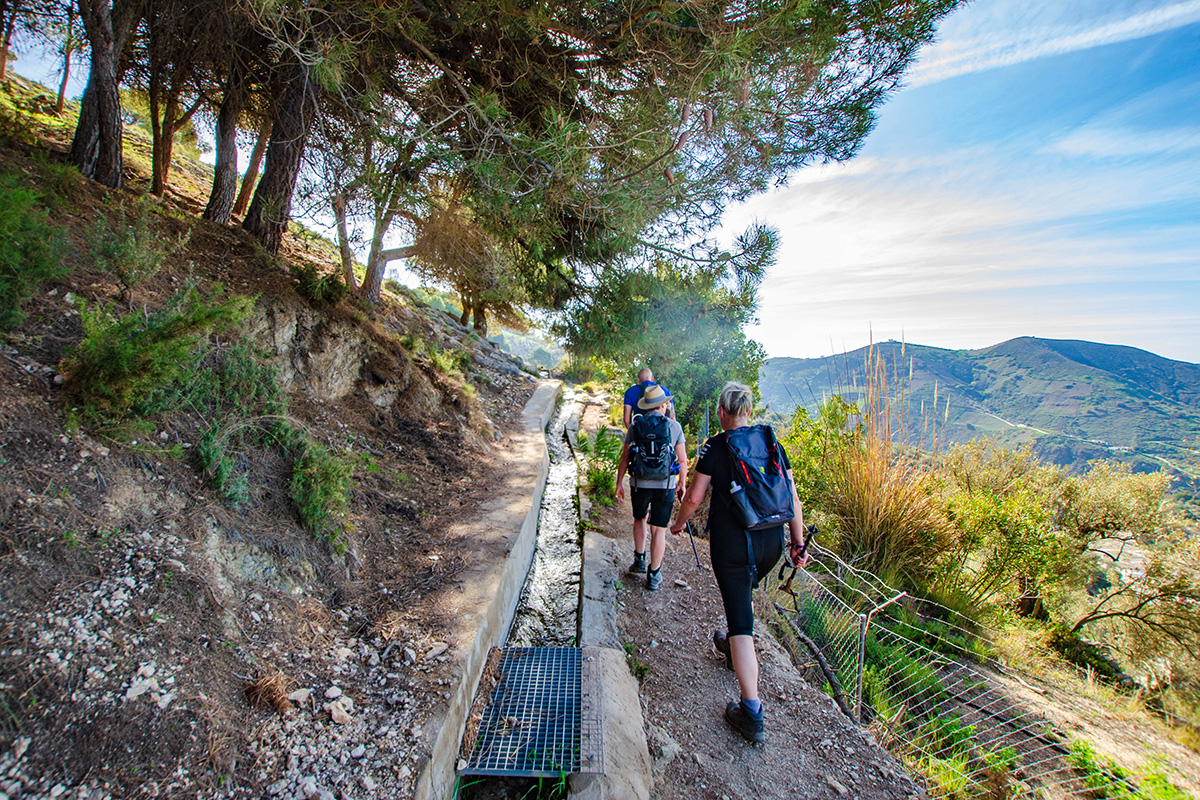
One of the pleasures of walking in the Axarquía is that this history isn't confined to museums or archaeological sites. We regularly walk beside acequias, cross old agricultural terraces and follow paths through landscapes shaped by centuries of water management.
Above Frigiliana, the Acequia de Lízar carries water high across the hillside from the Río Higuerón. The wider hydraulic landscape around the village has strong Andalusi and Morisco associations, with water used for agriculture and, over time, to power mills and other economic activity. The surviving channel has been repaired and modified over generations, but it belongs to a much older tradition of managing mountain water.
Around Cómpeta, an old acequia on the route towards Canillas de Albaida, now partly piped, continues to supply cultivated terraces. Combined with the documentary evidence from the 1575 repartimiento, it provides a fascinating link between the Morisco agricultural landscape and land that continues to be cultivated today.
Canillas de Aceituno adds another dimension to the story. Silk production was historically important here, with mulberry trees cultivated to provide leaves for silkworms. Irrigation formed part of the agricultural economy that helped support silk production, while the village's Casa de la Reina Mora, or Casa del Diezmo, still provides a reminder of that period and its association with the production and trade of silk.
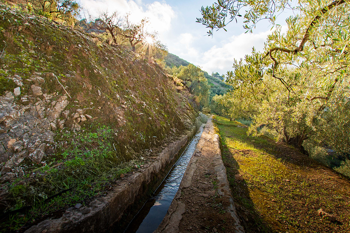
Then there is the Río Chíllar, where we walk beside a high-level acequia with the river far below. It provides one of the clearest examples of these waterways in the landscape, carrying water along the side of the valley before parts of the modern system eventually connect with water-storage infrastructure north of Nerja.
None of these waterways should simply be treated as untouched Moorish monuments. Some have been rebuilt, lined with concrete, diverted or partly replaced by pipes, and precisely dating the surviving structures can be difficult. What we're walking beside is something more interesting: a tradition of moving and managing water that has survived because generation after generation continued to need it.
Looking at the Landscape Differently
The next time you walk beside an acequia, take a moment to look beyond the water. Follow the channel with your eye, notice how gently it crosses the mountainside, and then look at what lies below it. Terraces, orchards, old farmhouses and villages can all form part of the same story.
Something that can appear quite insignificant beside the path helps us understand how generations of people lived and farmed in a landscape where water has always been precious. The channels have changed, been repaired and adapted, but the principle behind them has endured.
We often think of history as something preserved in castles, churches or archaeological sites. Here, much of it is still woven into the landscape we walk through. An acequia may be one of its smallest features, but once you understand where the water came from and where it was going, you begin to see everything around it differently.
