If this is your first walking holiday to Andalucía, or you're looking to return for another visit, then this weekend offers a brilliant insight into walking in the inland areas of Malaga.
The three days combine a wide array of sights and scenery and their own unique challenges (crossing the gorge in the Tajo de Molino, scrambling over the Doña Ana ridge, and the continuous ascent up to Comares). Still, they also highlight what is truly great about walking in Andalucía.
Our walking holiday is not just a physical challenge; it's a journey through history, geology, and culture. Each walk allows an opportunity to delve deeper into the rich heritage of Andalucía, where you can glimpse a taste of this cultural and historical wealth, and which will surely leave you with a desire to return.
Off we go!
Moors of Iberia
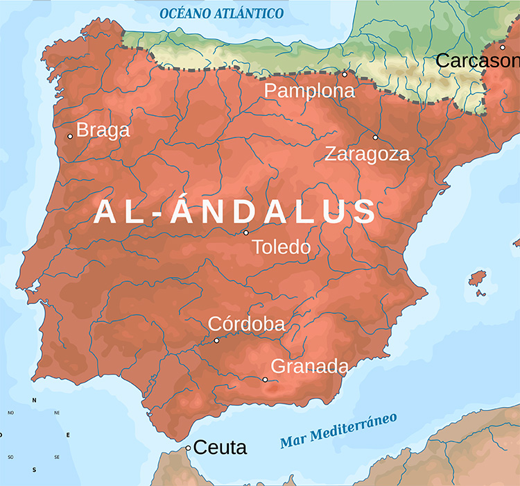
The Moorish Invasion and subsequent occupation of the majority of the Iberian Peninsula, Al Andalus, lasted over 700 years. There are books, and indeed probably libraries of books, on this period, but for the purpose of our weekend, it is the fortresses, villages and towns where remnants of these long-past invaders that make our walks more interesting.
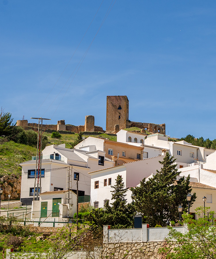
Castillo de Estrella, Teba
One of the most captivating stops on our Teba walk is the Castillo de Estrella. Dominating the skyline high above the town of Teba, this 13th-century castle was built to protect the large population scattered along the Guadalteba and La Venta rivers. While it may be a mere shadow of its former self, the Torre de Homenaje still stands, now housing an interpretation centre that provides insights into the crusades on the Guadalteba and the significant battle for Teba, where Sir James Douglas, a Scottish Knight-Errant, met his end.
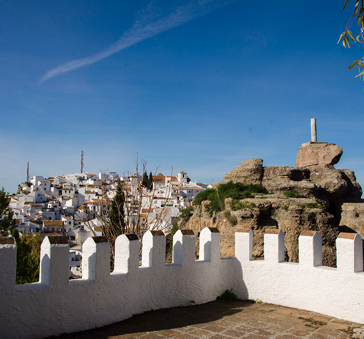
Moorish Hillfort of Comares
Perched atop a narrow rocky ridge, the town of Comares is very imposing, and one can easily see why the Moors built a defensive fortress here as early as the 8th Century. Comares is one of three castles built in the Axarquía region, of which the others, Bentomiz and Zalia, are visible from Comares. The fact that the Moors built three fortresses in such proximity indicates how important this area was, no doubt protecting the Pass of Zafarraya, a vital trading route towards Granada.
There is little left of the fortress in Comares other than a Watchtower, which would have once guarded the only approach into the compound. However, a very peaceful and beautiful cemetery now occupies this position, and tucked away in the corner, the old Aljibe (water well) can still be viewed.
Scattered across the narrow ridge are the white-painted houses that make up the town and would have been in the area that was once outside of the fortress. It is a charming town in an impressive location.
In the town's central plaza is the Balcon de Axarquía, which offers breathtaking views to the south, overlooking the coast, and to the east, where La Maroma, the highest mountain in the province of Malaga, can be seen.
Exploring this town's small passages and streets will reveal other hidden gems, such as several small arches believed to date back to the Moorish period. You can also find the Plaza de Verdiales, where a traditional local festival is held once a year, and the Calle de Perdon, where the Muslims who were captured during the reconquest were pardoned in exchange for renouncing their religion.
No visit to Comares is complete without a stop in the Café Bar Tres Balcones, where we enjoy a superb range of tapas and cool drinks in the shade of this narrow street.
Before the Moors
Evidence shows that Neolithic humans arrived during the Palaeolithic period, around 200,000 BC, and remnants of this can be found throughout much of Andalucía.
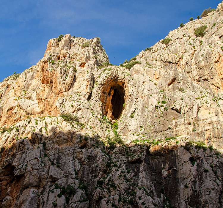
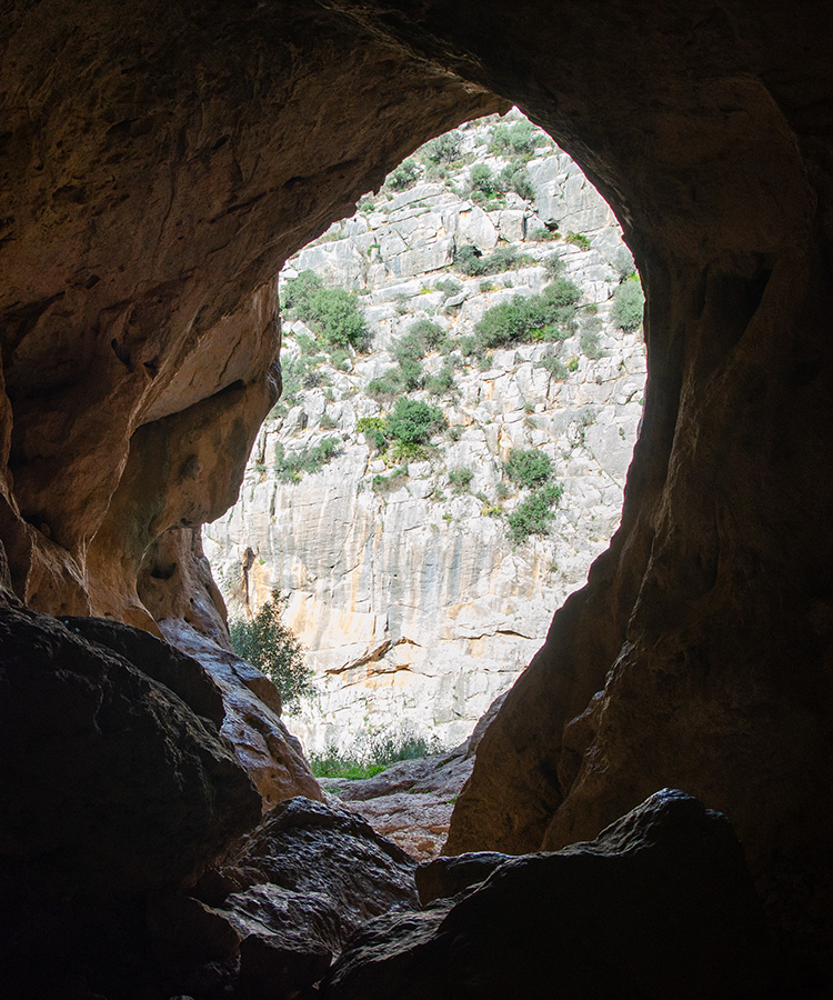
Cuevas de las Palomas
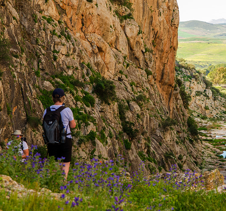
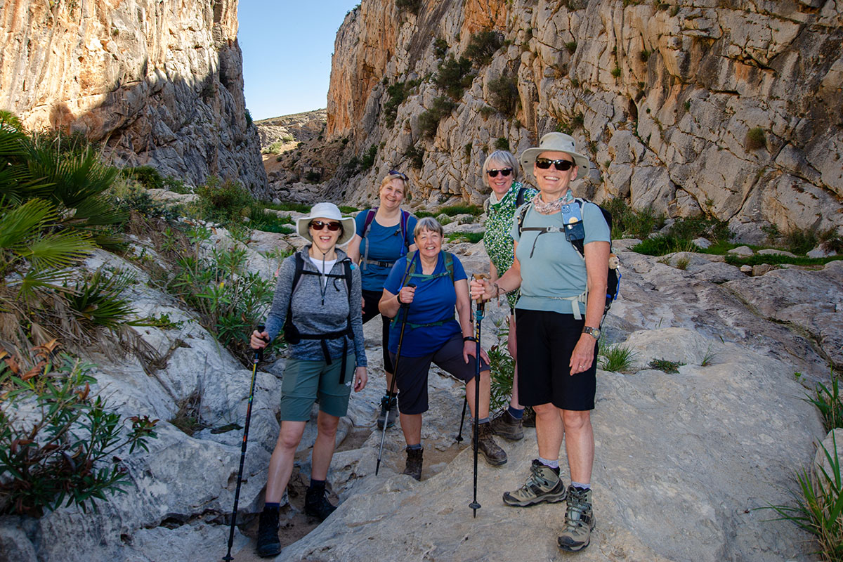
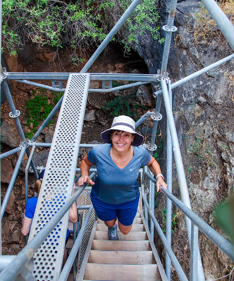
At the beginning of the Teba walk, we have the opportunity to take a short detour to visit the Cuevas de Las Palomas. The cave has a unique location, with one entrance opening directly into the Tajos de Molino gorge. We use the entrance from above and descend, using a scaffold tower, directly into the cavern's mouth. Artefacts found in the area suggest that it was occupied for at least 50,000 years.
It takes little imagination to imagine how, thousands of years ago, this area, with the nearby rivers and the dense forests in the Guadalteba Valley, would have provided much sustenance for Neolithic hunters.
Pass of Zafarraya and the Nasrid Road
The mountains in the north of the Axarquía valley form part of the Central Limestone Arch, and on its easterly end is the pass of Zafarraya. This pass is not part of our weekend walks, but as it is such a prominent natural feature, with the gap in the mountains that allows passage onwards so striking, and as it is visible from Comares and very evident when we stand at the eastern edge of the cemetery, it deserves mention.
The pass has many connections with the past: from the Moors, who built the fortress of Zalia to guard this vital trade route, to the consortium of Belgian businessmen who, in the early 20th Century, financed a narrow-gauge railway that was to run between the cities of Malaga and Granada.
But for our Neolithic hunters, who no doubt used this pass to move between the coastal and mountain areas, the caves and caverns in the nearly vertical walls of the rockfaces on either side of the gap offered a temporary home. One excavated cavern indicates use dating back 40,000 years.
The Central Limestone Arch
Some may not immediately know that there are significant mountains in Southern Spain, and other than the Sierra Nevada, with the peak of Mulhacen being the highest mountain in mainland Spain, you'd be hard-pressed to name others.
As you make that final descent into Malaga airport, whether on the left or right of the aircraft, you will see mountains stretching away into the distance.
The mountains beneath are part of the Gibraltar Arc, formed by the convergence of the Eurasian and African plates. It consists of the Baetic Cordillera (southern Spain) and the Rif (North Morocco) mountains.
The Baetic mountains have three ranges: Prebaetic, Subbaetic, and Penibaetic. The Penibaetic range is the southernmost system and runs along the south coast of Andalucía, from the province of Cádiz across the province of Granada into the Region of Murcia.
Within this system lies a unique collection of mountain ridges, valleys, and passes called the Central Limestone Arch.
This mountain range extends in an east-west direction, from the port of Alazores to the Gaitanes gorge, for about 50 km in length in which the mountain ranges divide the provincial territory into two sectors, serving as a climatic border between the Antequera Depression to the north, and the Valle del Guadalhorce and Axarquía, to the south, at the same time that it serves as a link between the Sierra de las Nieves, to the west, and the Sierras de Tejeda and Almijara, to the east.
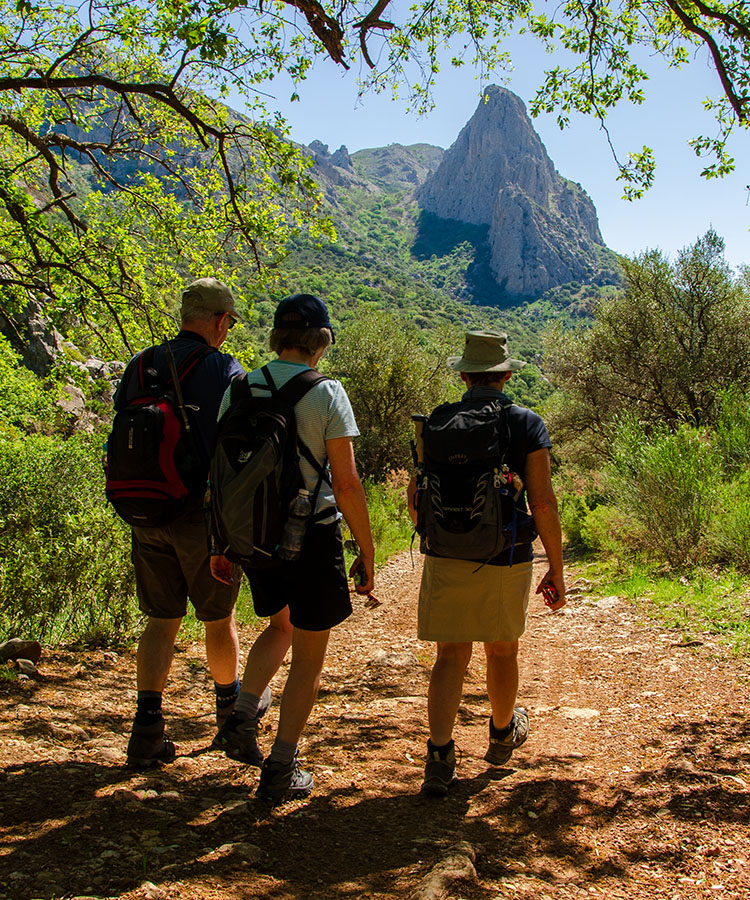
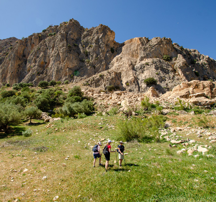
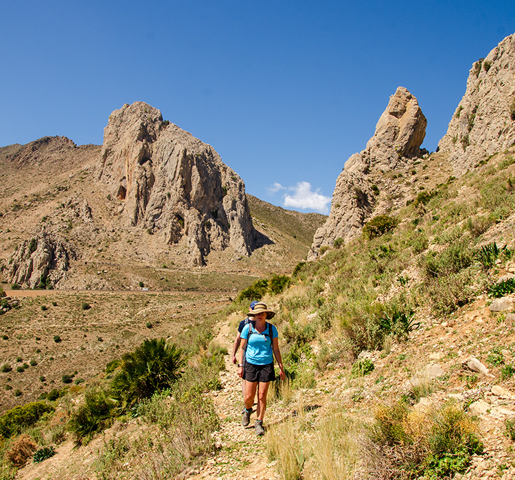
As we explore Tajos de Gomer, we have the chance to walk beneath the Sierra del Jobo, a significant part of the Central Limestone Arch. This allows us to witness the impressive near-vertical cliff faces and sharp ridgelines up close. Although the Tajos de Gomer are just south of this system, they are still a cluster of dramatic peaks worth exploring.
The Central Limestone Arch is an impressive range, and our walks are always within sight of these mountains.