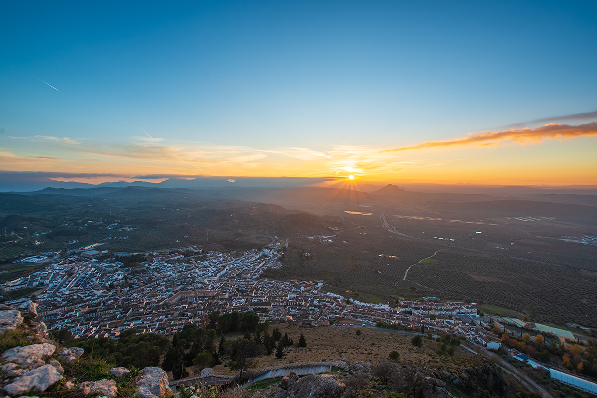
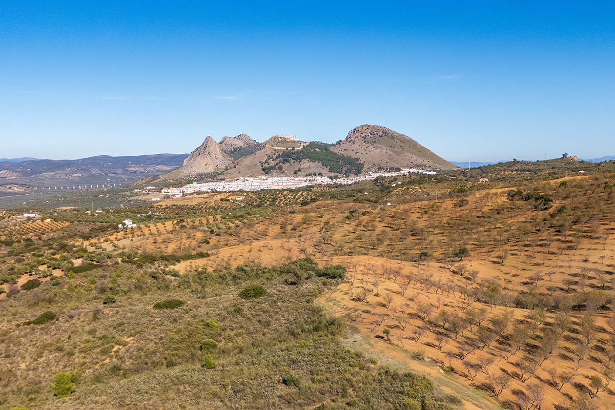
The countryside around Archidona can be deceptive. Approaching from the west, much of the land appears broad and relatively flat, particularly when compared with the limestone mountains that rise farther south. Archidona itself stands out clearly, with the old fortress and the Santuario de la Virgen de Gracia occupying the hill above the modern town.
Yet immediately south of Archidona lies something that is remarkably difficult to appreciate from a distance. Hidden amongst the surrounding agricultural country is the Hoz de Marín, a deep, curving canyon cut by the Arroyo Marín. The contrast between the open landscape above and the enclosed, greener environment within the canyon helps explain why this relatively small area contains far more variety than it first appears.
Leaving Archidona
South of Archidona, agriculture dominates the countryside. Olive and almond groves cover much of the land, interspersed with pine and open ground. In the early months of the year, flowering almond trees add white and pale pink to the landscape, while the higher ground offers extensive views across the surrounding countryside.
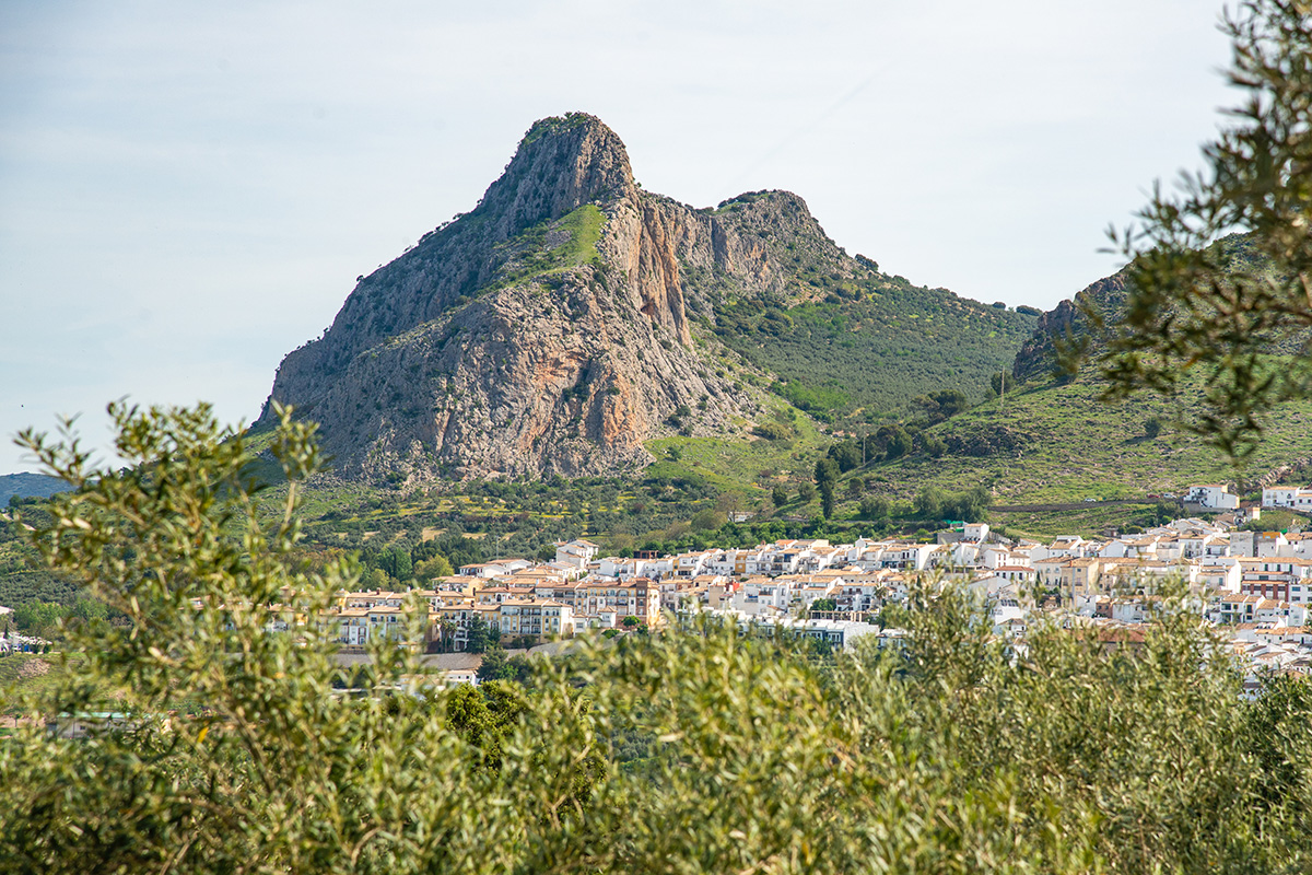
To the west lies the broad landscape around Antequera, with the distinctive profile of Peña de los Enamorados rising in the distance. In the opposite direction, the fortified hill above Archidona remains one of the most prominent features. From many positions, you can see the castle walls and the Santuario de la Virgen de Gracia, a reminder that the older settlement occupied the heights above the modern town.
It is a spacious landscape, and one that gives little indication of the canyon concealed within it. Even around Las Lagunillas, where the geology is already beginning to tell us something about what lies ahead, the country remains predominantly agricultural. Only close to the edge of the Hoz does the scale of the feature become apparent.
The Hoz de Marín
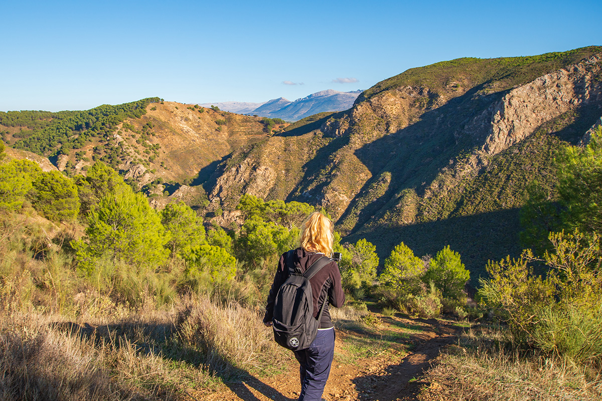
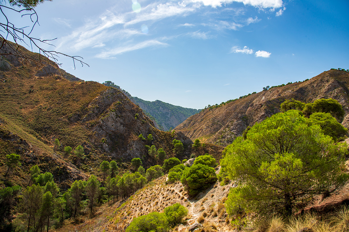
From above, the Hoz de Marín appears as a deep, curving break in the surrounding countryside. Steep slopes descend towards the Arroyo Marín, creating a landscape very different from the open olive and almond country only a short distance away.
The explanation lies partly in the geology. Archidona sits amongst the limestone and dolomite landscapes familiar across this part of Andalucía, but around the Hoz de Marín we encounter a much more complicated group of rocks. Particularly important are gypsum-rich materials formed during the Triassic period, more than 200 million years ago.
Gypsum behaves differently from the hard limestone mountains nearby because it dissolves relatively easily in water. Over long periods, water moving through the ground has created hollows, depressions and other karst features, while the Arroyo Marín has progressively cut down through the terrain. The Hoz is therefore described as a fluvio-karstic canyon, shaped by a combination of flowing water and the dissolution of the rocks through which it passes.
Some effects are visible beyond the canyon itself. Around Las Lagunillas, gypsum dissolution has helped create depressions where water can collect seasonally. What initially appears to be fairly ordinary agricultural country is therefore part of the same geological landscape that has produced the Hoz de Marín.
A Different Landscape Below
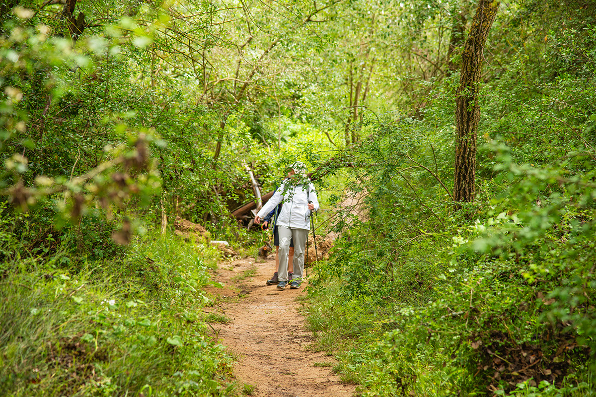
The difference becomes much more obvious inside the canyon. The open views disappear, steep slopes provide more shelter, and the Arroyo Marín brings water through the valley floor. Together, these create noticeably greener conditions than those found across much of the surrounding agricultural land.
Poplars, ash and other trees associated with wetter ground grow close to the stream, while Aleppo pine and Mediterranean vegetation occupy the slopes. In spring, wildflowers and increased bird activity make the contrast particularly noticeable. Even later in the year, when the countryside above can become much drier, the bottom of the Hoz often retains its greener character.
The Arroyo Marín is itself part of a much larger story. After passing through the Hoz, its water eventually joins the Guadalhorce, linking this secluded canyon with the river system that drains much of the landscape around Antequera before continuing towards the Mediterranean.
Evidence also suggests people once made greater use of the valley's sheltered conditions. Old agricultural terraces, olive trees and the remains of rural buildings survive amongst the vegetation, while some areas were cultivated as small huertas. Water and shelter made this a useful agricultural space, despite the steep ground surrounding it.
Much of that cultivation has now disappeared, and natural vegetation has returned to former terraces and abandoned ground. This mix of running water, woodland, old agriculture, and steep canyon sides gives the Hoz its distinctive character. It feels surprisingly separate from the open landscape immediately above it, even though the two are only a short distance apart.
Returning to Archidona
Once you leave the canyon behind, Archidona again becomes the dominant feature in the landscape. The Santuario de la Virgen de Gracia and the remains of the fortress stand above the modern town, but their elevated position is about more than simply providing a good viewpoint.
Medieval Archidona was centred on the fortified heights of the Sierra de Gracia rather than in the lower town we see today. Under Muslim rule, the settlement became an important defensive position and later formed part of the frontier territory of the Nasrid Kingdom of Granada. Its location provided both protection and extensive views across the surrounding country. Christian forces captured Archidona in 1462, and over the following centuries the focus of settlement increasingly shifted to the lower ground.
The sanctuary preserves a particularly interesting connection with that earlier town. It incorporates the former mosque of the Muslim settlement, while the old minaret survives as the bell tower. What appears from below to be simply a church beside the remains of a castle is therefore part of medieval Archidona itself.
The lower town tells a later story. Among its most distinctive features is the Plaza Ochavada, completed in the 18th century. Its unusual eight-sided form belongs to a very different period from the fortified settlement above, illustrating how Archidona developed after its medieval defensive role had diminished.
Looking Back Across the Landscape
The Sierra de Gracia offers perhaps the best place to understand how these different parts of the landscape fit together. From the heights above Archidona, the view extends across the broad country around Antequera towards the mountains of the Central Limestone Arch. Other views reach towards the Guadalhorce Valley and reservoirs, the country around Campillos and the mountain ranges farther north.
Seen from above, much of this landscape once again appears broad and open. The Hoz de Marín is surprisingly difficult to spot, despite the canyon's scale when viewed from its edge or experienced from below.
That contrast helps explain what makes the landscape around Archidona so interesting. The limestone heights, gypsum-rich country, agricultural land, and sheltered canyon sit remarkably close together, while the fortified Sierra de Gracia adds a human story shaped by the same geography.
The Hoz de Marín is perhaps the best example of how much can remain concealed within a landscape that initially appears relatively simple. From a distance, little suggests the deep, green canyon hidden amongst the olive and almond country south of Archidona. Understanding why it is there, and how people have used the surrounding landscape, changes what we see.
The landscape itself hasn't changed. What changes is how much of it we have learned to recognise.