Before We Enter the Gorge
The story of the Caminito del Rey begins a little further north, where a low sandstone ridge sits surrounded by the waters of the Guadalhorce reservoirs.
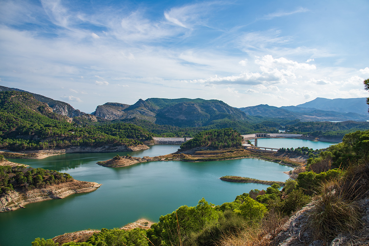
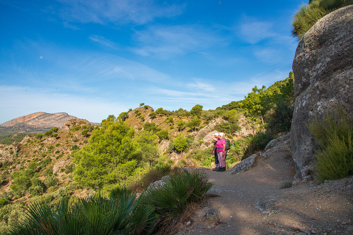
A short walk around this ridge is lovely in its own right, but it also gives us a particularly good introduction to the story ahead when we climb to the Mirador de Tres Embalses. From here, three great bodies of water spread out around us, fed by rivers that have travelled through different parts of inland Málaga before meeting beneath the limestone mountains ahead.
We can see the contrasting sandstone and limestone landscapes and the mountains narrowing towards the Desfiladero de los Gaitanes. Somewhere through that great barrier lies the Caminito del Rey.
Most people know the Caminito for its boardwalks suspended high above the gorge. They are spectacular, but only part of the story. The path exists because, more than a century ago, engineers looked at these rivers, mountains and the enormous difference in height through the gorge and saw something quite different: water that could be put to work.
Three Rivers Meet the Mountains
Standing at the viewpoint, we are looking across water gathered from three different rivers. The Guadalhorce approaches from the north-east, the Guadalteba from the north-west, while the Río Turón feeds the Conde del Guadalhorce reservoir from the west. Each drains a different part of the surrounding countryside, but here their stories come together.
The reason lies in the landscape. Across the wider Guadalhorce Basin, water is channelled towards the great limestone barrier to the south. Ahead of us, the mountains close around the river until the water is forced through the narrow Desfiladero de los Gaitanes on its journey towards Málaga and the Mediterranean.
Our morning walk gives us a particularly good way of seeing that change. Beneath our feet are the warmer-coloured sandstones of the ridge, weathered into rounded hollows and cavities, while the harder limestone mountains increasingly dominate the landscape around us.
Long before there were reservoirs, dams or a walkway clinging to those cliffs, the geography was already determining where the water would go. Much later, people recognised the possibilities created by that landscape and began finding ways to control it.
Learning to Control the Water
People began taking a closer look at the potential of these rivers around the beginning of the twentieth century. Initially, much of that interest centred on hydroelectric power, but over time water was also stored for irrigation and drinking water, while the dams helped regulate a river that had caused devastating flooding downstream.
The most striking reminder of those early ambitions is the Conde del Guadalhorce dam, completed in 1921 across the Río Turón. Its stonework and elegant arches look very different from the enormous embankment dams that created the neighbouring Guadalhorce and Guadalteba reservoirs during the 1960s and early 1970s.
That transformation came at a cost. The later reservoirs submerged land, altered roads and the railway, and led to the abandonment of the village of Peñarrubia. The landscape we admire today was created through remarkable engineering, but also through changes that profoundly affected the people who lived here.
From the Mirador de Tres Embalses, we can see different generations of dams holding back water gathered from three rivers before it continues towards the Gaitanes Gorge. Yet storing water was only part of the story. The extraordinary geography ahead offered another possibility: its fall through the mountains could be used to generate electricity.
Why the Caminito Was Built
By the beginning of the twentieth century, engineers had recognised something remarkable about the Gaitanes Gorge. Between Gaitanejo at its northern end and El Chorro to the south, the river loses around 100 metres in height. That difference represented energy waiting to be used.
Rather than allowing all the water to make that descent naturally, part of it could be diverted into a channel and carried through the gorge at a much gentler gradient. By keeping the water high for longer, engineers could release it near the southern end through a much steeper drop, using the resulting force to drive turbines and generate electricity.
Building and maintaining this system through a deep limestone gorge presented an obvious problem: workers needed access. Between 1901 and 1905, workers built a narrow service path along the cliffs so they could move between the hydraulic installations and maintain the water channel. That path became what we now know as the Caminito del Rey.
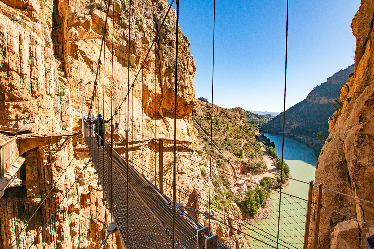
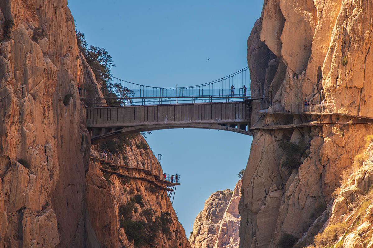
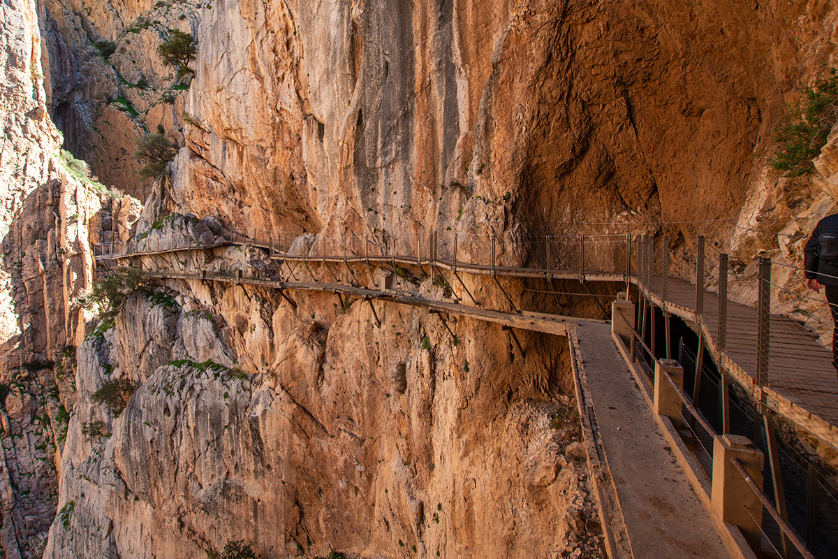
When we walk through the gorge today, the boardwalks naturally command our attention, clinging in places to near-vertical rock faces hundreds of metres above the river. But parts of the original engineering remain. Old water channels, tunnels and remnants of the earlier walkway remind us that the Caminito wasn't created for walkers looking for an adventure. It was built because people had found a way to put the water of the Guadalhorce to work.
A Path Through People's Lives
The Caminito began as a practical route for workers, but gradually became part of everyday life in the gorge. As families settled around the hydroelectric installations at Gaitanejo and El Chorro, the path connected the small communities growing up around them.
It is difficult to imagine today, as we put on our helmets and pass through the controlled entrance, but children once used this route to get to school. People crossed it to reach work, buy provisions or visit friends and neighbours, while others travelled it on horseback and even by bicycle. Electric lighting allowed the path to be used after dark.
The royal connection came later. In 1921, King Alfonso XIII visited for the inauguration of the El Chorro dam, now the Conde del Guadalhorce. He crossed part of the existing walkway, after which the path increasingly became known as the Camino del Rey, and eventually the Caminito del Rey.
So the path wasn't built for a king or intended as the visitor attraction we know today. For the people who lived and worked amongst these mountains, it was something much more ordinary: a way of getting from one side of their world to the other.
Walking Through the Engineering
Once we enter the Caminito, the scale of the landscape changes completely. The broad views across the reservoirs are behind us and we are now inside the limestone barrier we looked towards that morning, following the Guadalhorce through narrow gorges and towering rock walls.
The modern boardwalks inevitably attract our attention, but there is much more to look for. Sections of the old water channel can still be seen beside the route, along with tunnels, control structures and remnants of the original walkway below us. Across the gorge, the railway repeatedly disappears into tunnels cut long before the first Caminito was built.
Knowing why the path exists changes the experience of walking it. Parts of the water system still carry water to the modern Nuevo Chorro hydroelectric station, where the height difference across the gorge is still used to generate electricity. More than a century later, the principle those early engineers recognised still works.
Towards the southern end, we also see the infrastructure of a much larger pumped-storage hydroelectric scheme. Water stored high above El Chorro can be released through turbines when electricity is needed and pumped uphill again when conditions allow. The technology and scale are very different, but both systems ultimately exploit the same thing: water and height.
From Three Rivers to El Chorro
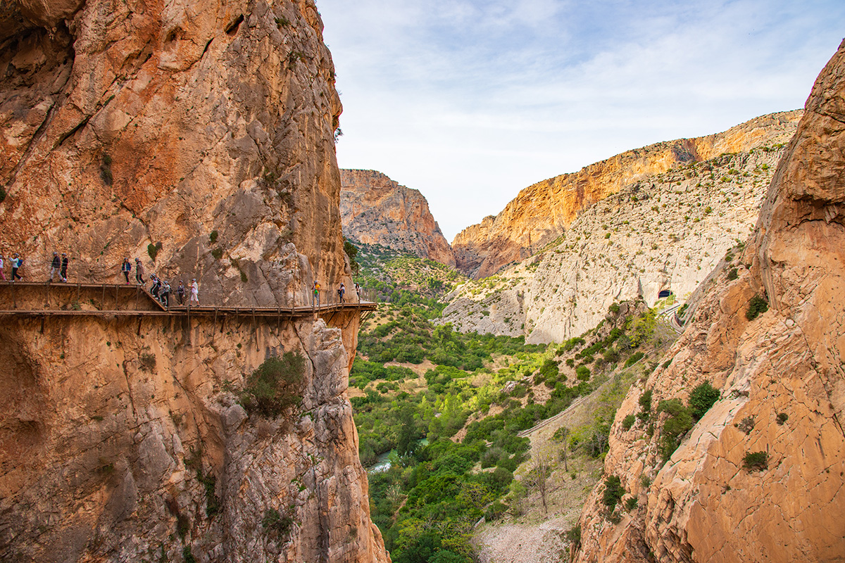
Eventually, the high boardwalks begin to descend, and we emerge from the Gaitanes Gorge towards El Chorro. The reservoirs we looked across that morning are now behind us, and the Guadalhorce continues south towards the lower valley and, eventually, the Mediterranean.
Even the name El Chorro brings us back to the water. Before the rivers were regulated by today's reservoirs and dams, floodwater arriving from inland Málaga could be forced through the narrow gorge and emerge at its southern end with tremendous power. The great gush or jet of water became known as el chorro, giving the settlement its name.
It is a fitting place to finish the day. That morning, we stood above the reservoirs looking towards the limestone mountains. Now we have walked through that barrier, following the water and the extraordinary engineering created to control and harness it.
The Caminito del Rey will always be spectacular, and perhaps that alone is enough reason to walk it. But once we understand the water, the path becomes something more. We are no longer simply walking through an extraordinary gorge; we understand why the Caminito is there.