It's not always about how far you walk or how high you climb during your day on the trail. Certain walks reveal their secrets and mysteries when you move slower and take the time to enjoy your surroundings. On this holiday, you will experience three such walks.
Why Unhurried?
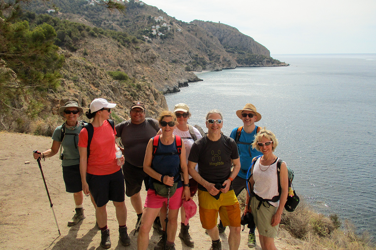
This holiday is an introduction to walking in Andalucía. Offering a variety of engaging routes and unforgettable destinations, we will explore areas with breathtaking scenery, enjoying a slower pace to appreciate our surroundings and not miss out on the intrigue and beauty of each day.
While this holiday is more relaxed, it still has its thrills. Over the three days, we'll navigate the karstic rocks of El Torcal, test our nerves on the vertiginous path along the Gaitanes gorge, and master the art of balance as we descend through the pine forests of Hondonero Meadow.
The aim is to offer a holiday that combines fun, challenge, and excitement.
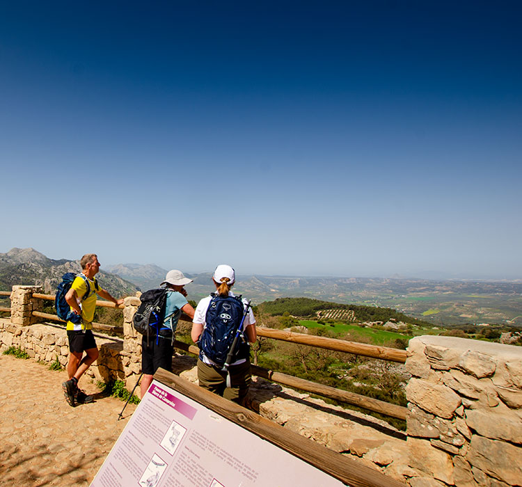
El Torcal de Antequera
When I started, this was one of the routes that made up most of my walking holidays. Setting off from the car park at the lower entrance and slowly ascending into the park, we followed a route around the bulk of the natural park. It was a full, demanding day of hiking.
We covered a lot of ground, passing through various terrain, but it felt like we needed more time to appreciate what we saw.
Revisiting this for the 'Unhurried' holiday and choosing a route almost a third of the length of the original, I realised there was so much to discover.
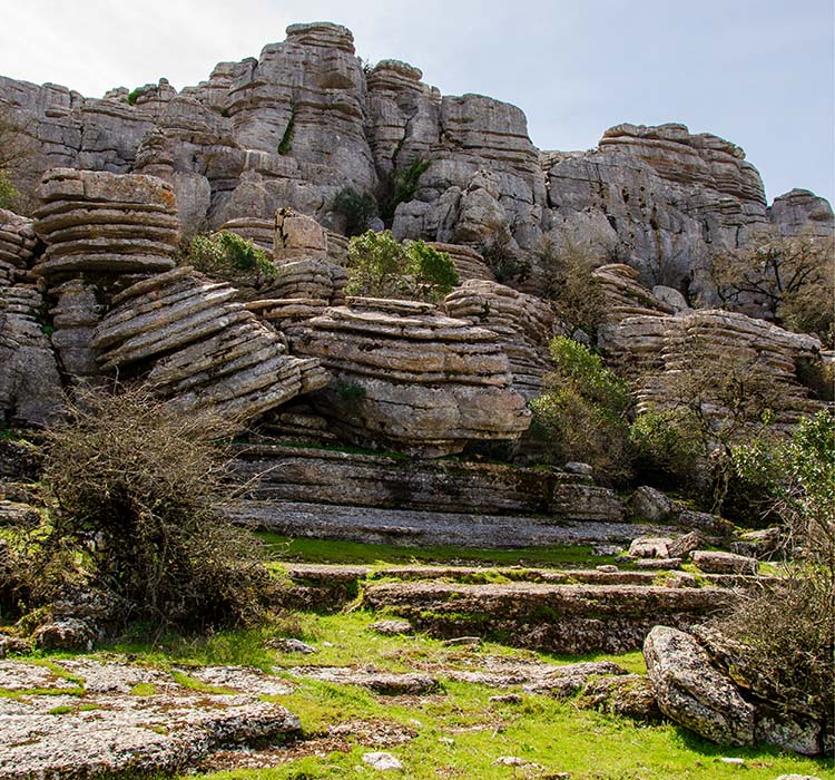
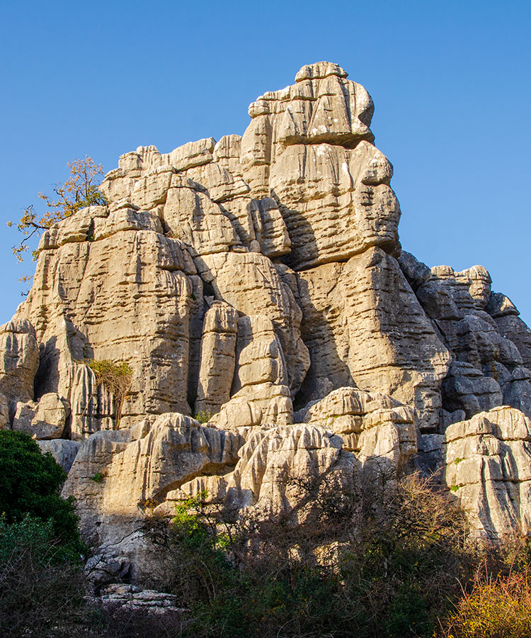
El Torcal is one of the most impressive karst limestone landscapes in Europe. This remarkable landscape, created by natural forces, is unique. The plateau has been thrust up from deep beneath the sea, spreading like a mushroom and remaining almost horizontal.
The geological structure of El Torcal favours the process of dissolving the limestones. This large mushroom-shaped fold, with large top and horizontal layers and short, steep flanks, allows water to accumulate on the surface and infiltrate the rock.
The karst behaves like a giant sponge, storing the rainwater and transmitting it to the interior, thus favouring the underground dissolution and forming the features we see today.
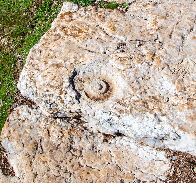
During the walk, we will cross small sections of limestone pavements and see how erosion has formed the clints and grikes. If you keep a watchful eye, you may be lucky to spot several fossilised ammonites along the way.
The most remarkable feature we pass is the pancake rocks with their irregular chasms and ridges. Softer, thin, mud-rich layers separate the layers of resistant bands of limestone, and the effects of erosion have left them looking like they have been stacked, just waiting for some maple syrup and bacon.
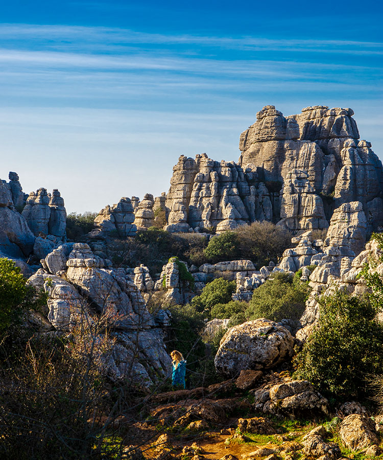
The central part of the natural park, where most visitors head, is incredibly impressive. However, before heading into the natural park, I will take you through two lesser-visited areas, the Seven Tables and the Labyrinth, where we may not see another soul.
The Seven Tables, named after the seven distinct pancake stacks on this plateau, are a vast area of pancake rocks. We can get close to these formations and see this erosion firsthand.
The Labyrinth is a fascinating path that links the Seven Tables to the Natural Park. As the name suggests, the path eventually leads us through a maze of limestone blocks and grykes, often under a canopy of hawthorn trees. As the path narrows, the grykes deepen, and the limestone walls become more imposing, you could imagine this as a scene in Steven Spielberg's Jurassic Park, and expect a Tyrannosaurus or Velociraptor to spring out on us at any time.
El Torcal is near the captivating town of Antequera, which we will visit after our walk. We will stop by the Portichuelo Chapel to enjoy local tapas and then take a short walk to the Mirador de las Almenillas, which has incredible views across Antequera.
The Plaza de Santa Maria is a short distance away, where we can view the Royal Collegiate Church of Santa María and the 11th-century Alcazaba.
Caminito del Rey - The King's Little Path
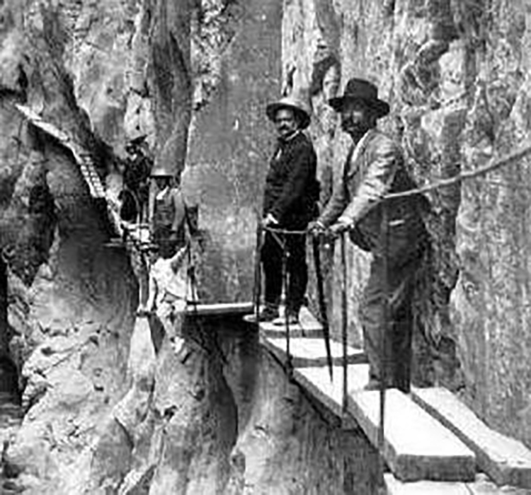
Before the construction of the new path in 2014, this route was, for a time, considered one of the most dangerous paths in the world. Indeed, many parts of the old path are still visible beneath the new, and only then can you see that those who walked/climbed/jumped and prayed their way along this path indeed had cajónes of steel.
Due to the tragedies and accidents in this area, a decision was made in 2010 to close the King's Pathway and destroy the southern access to the path. However, it did not deter the most adventurous from continuing to access it.
With that dramatic introduction out of the way, I should point out that the Caminito del Rey is not dangerous at all since the new path opened in 2015. Any photos, images, or videos you may have seen before the new path was opened certainly do not represent the experience you will have today.
I've walked this path many times. You are as likely to pass a group of teenage schoolchildren on a field trip, as you are a group of pensionistas from the local town who have organised a bus tour for a day out on the trail.
Why a pathway on the side of a gorge?
We must first examine the area's geography and geology to answer that question. The Rio Guadalhorce flows from the north of the Malaga province through the Gaitanes Gorge and finally enters the sea at Malaga.
At the northern entrance to the Gaitanes Gorge, where the path starts, the Rio's Guadalhorce, Turon, and Guadalteba converge. With a combined catchment area of nearly 1600 km2, they provided a powerful force that eroded the softer limestone and dolomite to create this stunning natural feature.
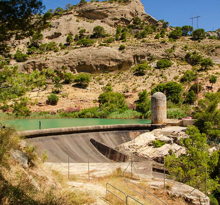
With such a volume of water flowing through this gorge, it was perfect for harnessing electric power. In 1914, work was started on the Guadalhorce Dam (later named the Conde del Guadalhorce), which would provide a controllable flow of water for the two hydro-electric stations, one at the start of the gorge and the other at the southern end of the gorge. It was completed in 1921.
To facilitate the workers' movement for these projects and the maintenance of the water canals, a path was constructed along the river's route, most spectacularly on the vertical walls of the gorge.
The original path was concrete and rested on steel rails supported by stanchions built approximately 45 degrees into the rock face. The work was challenging, and sailors from Malaga were called in to hang from ropes fixed at the top of the gorge.
The name of King's Path was given after the visit of King Alfonso XIII, who used this walkway to inaugurate the dam, Conde del Guadalhorce.
Caminito del Rey Tourist Attraction.
The new walkway, which cost 9 million euros, was started in 2013 and completed in only 12 months. It opened in 2015, and over 300,000 people visit it annually.
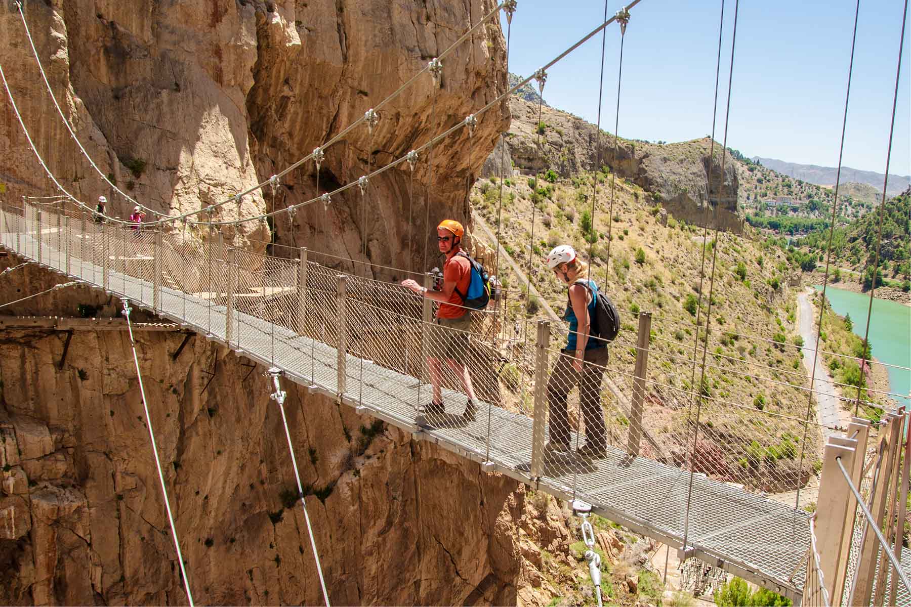
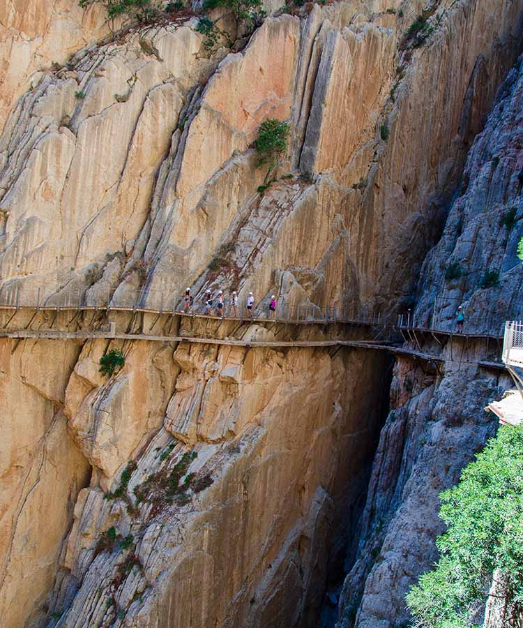
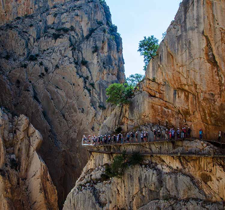
The new path follows quite accurately the route of the old path, often just built above the old. Although the route is only around seven kilometres long, it is in a truly stunning setting.
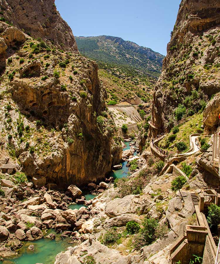
Upon entering the walk, we find ourselves immediately in the Gaitanes Canyon, in places just ten meters wide. This leads us to the El Tajo de las Palomas canyon, which becomes deeper and wider, where an old footbridge spans the gorge and was used for transferring staff and materials from the adjacent railway line.
We leave the Canyon and enter the Valle de Hoyo, best imagined as a valley. Here, we have a clearer view of the adjacent railway line and views up towards the eastern flanks of the mountain of El Humo. The path here gently undulates, descending slowly to the last Canyon, the Gaitanes Gorge.
It is fitting that the most exciting part of this walk comes at the end. As we leave the gently sloping sides of the Valle de Hoyo, we set foot back on the walkway, which leads us out over the gorge below. This final exciting section is along a hanging section of the boardwalk that winds through the overhanging walls in a narrower route that borders the Gaitanes' Gorge.
The boardwalk is 800m long, fixed 100 metres above the river, on over 250 metres tall rock walls. Along this path, we can see the geologic processes that have twisted the limestone beds through 90 degrees, forcing them towards the sky.
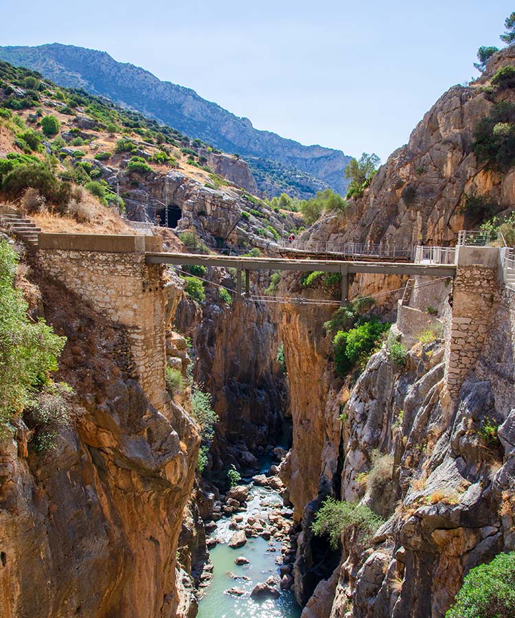
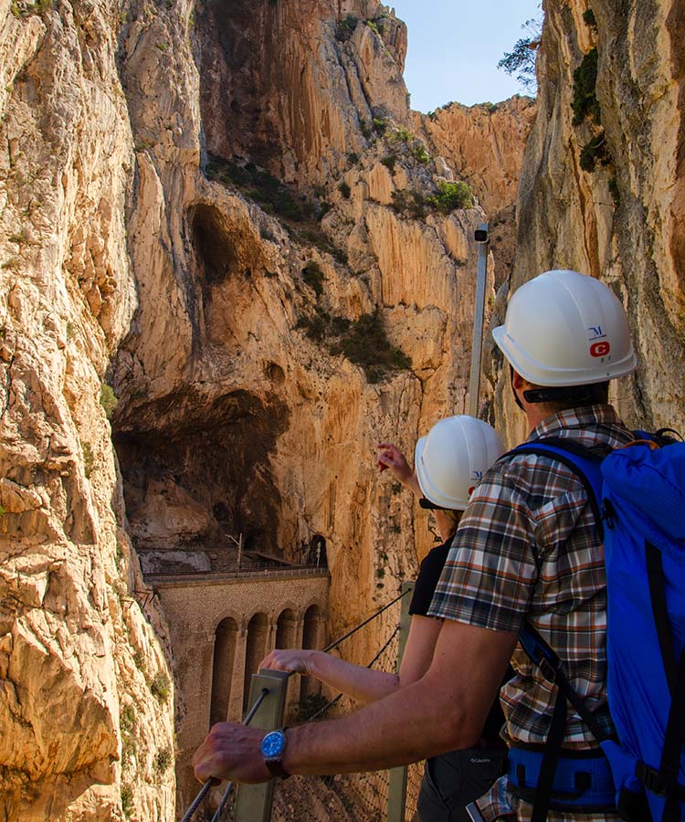
As we reach the end of the Gaitanes Gorge and break out onto the open rockfaces above the village of El Chorro, we cross the suspension bridge that hangs above the Aqueduct.
The bridge is fixed into the gorge's walls, 105 metres above the Canyon below, and spans 35 metres. As it is fixed across the end of the gorge, we have the open space above the water on our right, giving you a sensation of emptiness.
On your way across the bridge, pause for a few seconds to look down. The walkway is a metal grid, which allows you to appreciate the abyss below.
Upon leaving it, you can spot the group of 'Jurassic Limestones' on an entirely vertical stratum that falls over the waters and opens the Canyon.
A short walk brings us to El Chorro, where we stop for a cool drink. Then, it's a short trip by bus back to the start. You are now Caminiteers!
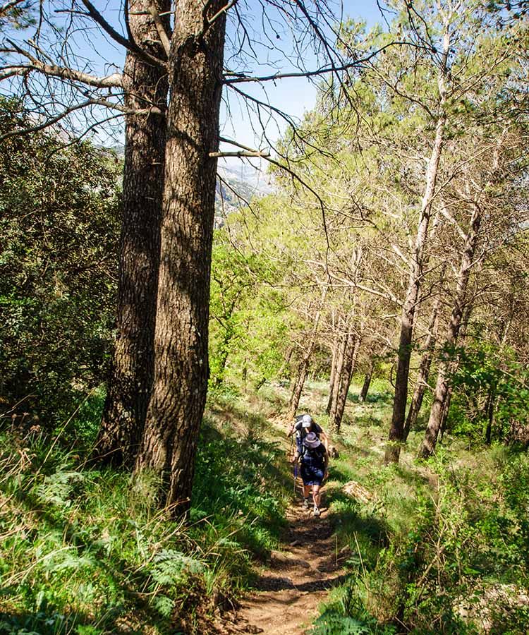
Hondonero Meadow and the Central Limestone Arch
After the previous two days' hustle, bustle and excitement, we're returning to nature for a more traditional walk.
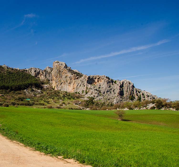
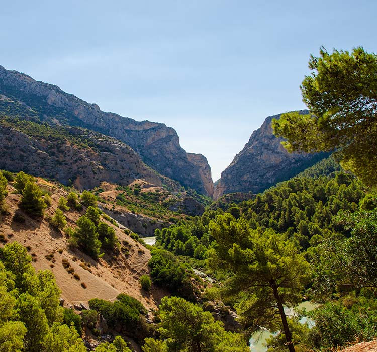
This circular walk is less crowded and focuses on the Hondonero Meadow. It is located on the northern slopes of the Sierras del Jobo and Camarolo, part of the Central Limestone Arch, a 50-kilometer-long chain of mountains, with the Antequera Depression disappearing towards the north as a backdrop.
The longest walk of the holiday, our route up to the meadow will take us through olive groves and Aleppo pines. The path weaves its way through broken karst limestone, eventually arriving at the Hondonero Viewpoint.
From this viewpoint, we can now connect the last two days. The more significant part of the Central Limestone Arch extends to the east. Within it, we can see the plateau of El Torcal, and further east is the summit of La Huma, which towered above us as we traversed the final boardwalk along the Gaitanes Gorge.
Stretching north, the Antequera Depression starkly contrasts with the mountains behind us. This basin consists of rolling fields, where olives and crops grow together, dotted with hills, and where water is usually abundant. With rainfall, streams are unable to form on this uneven terrain, so the water accumulates in the centre, forming lagoons such as the Campillos Lagoons, Archidona Lagoons, Ratosa Laguna, and the largest, the Fuente de Piedra Lagoon, the birthplace of thousands of flamingos every year.
Although small, the Hondonero Meadow has been significant for many millennia. Settlements were recorded from the Palaeolithic era until the Roman occupation, where crops were grown and grazing animals found sustenance. Today, the area is used for recreation, with climbing, walking, and bird watching the most popular activities.
We finish our walk beside the source of the river Chorro, which eventually feeds into the Guadalhorce reservoir north of the Gaitanes Canyon. This small stream is a unique environment in which willows, osiers, elms, Moorish ferns, sazgatillos, horsetails, and false brooms abound.
The time of year that we walk will influence what flora and fauna we see, but over the many times I have walked this, I have been fortunate enough to spot the Southern Spanish Ibex, Iberian Red Fox, the breathtaking Griffon Vulture, Little Owl, Bee Eater, Hoopoes, Crested Titt, and many more.
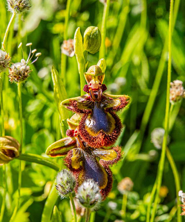
In the spring, and certainly after rainfall, the profusion of flowers along the path can easily add to the time of the walk, as it's too tempting to stop to identify them. Bee orchids, tassel hyacinth, bladder vetch, butterfly orchid, lesser butter and eggs, Jerusalem sage, and, on rare occasions, the beautiful mirror bee orchid.
This is a great way to conclude your weekend of walking in Andalucía, and I hope you'll be eager to come back for more.