
A Landscape Shaped by Al-Andalus
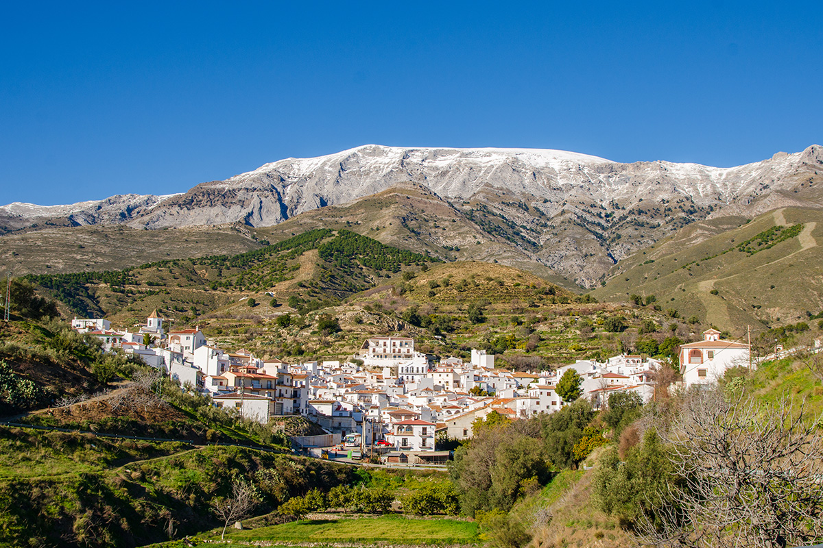
In the hills behind Málaga's Mediterranean coast, whitewashed villages sit beneath the mountains of Sierra Tejeda and Sierra Almijara. Between them are olive groves, cultivated terraces, wooded valleys and pathways that have connected these communities for centuries. Much of the character of this countryside developed during the long period when southern Spain formed part of Al-Andalus.
That history began in 711, when Muslim forces crossed from North Africa into the Iberian Peninsula. Over the following centuries, Al-Andalus became an important centre of agriculture, learning, craftsmanship and trade. Its territory and political boundaries changed considerably, but Muslim rule continued in the Kingdom of Granada until 1492.
The Axarquía formed part of that final Muslim kingdom, governed by the Nasrid dynasty. While Granada was its political and cultural centre, smaller communities in the surrounding mountains supported themselves through agriculture, animal husbandry and local trade.
The influence of this period can still be seen in the villages and countryside. Old irrigation channels, hillside terraces, surviving buildings and the arrangement of narrow village streets all help explain how people lived and worked in what was often difficult terrain.
The Mountain Roads to Granada
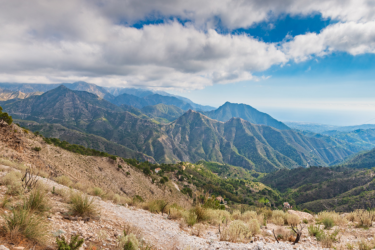
The mountains of the Axarquía may look like a formidable barrier, but they have never completely separated the coast from the interior. For centuries, people travelled through these hills, following routes between villages, agricultural settlements and the larger towns. Farmers needed access to their fields, muleteers transported goods, and traders crossed the mountains to reach inland markets.
One important passage was the Boquete de Zafarraya, a broad opening through the mountains that connected the Axarquía with the country around Alhama de Granada and the routes leading toward Granada itself. During the Nasrid period, the wider route between Málaga and Granada was important enough to warrant castles and watchtowers to protect communications through the region.
Other routes, often known as Caminos de Granada, crossed the Sierra Tejeda and Sierra Almijara. Some were used by muleteers and people working in the mountains, with roadside inns providing food and shelter for travellers and their animals.
The paths have changed over the centuries. Some have been widened into tracks or roads, while others have fallen out of use. We cannot assume that every old-looking pathway dates from the Moorish period, but the geography that determined where people could travel remains much the same. These historic connections help explain why the villages developed where they did, and why routes through the mountains were so important to their inhabitants.
The White Villages Beneath Sierra Tejeda
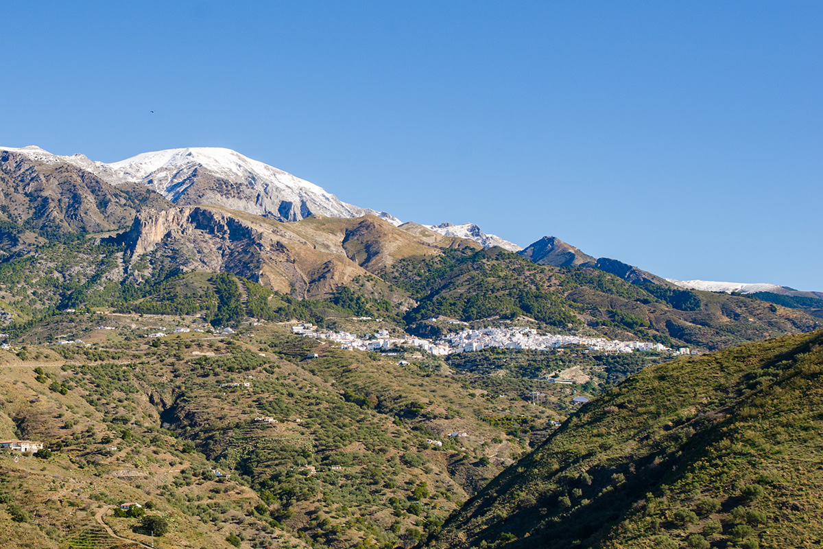
Sedella, Salares, Canillas de Albaida and Cómpeta occupy the southern slopes of Sierra Tejeda, between the higher mountains and the cultivated hillsides of the Axarquía. Their settings have much in common, although each village has its own character. Whitewashed houses cluster along narrow streets, while olive groves, orchards and terraces extend across the surrounding slopes.
Water has always been essential to farming here. Springs and streams descending from the mountains supplied villages, gardens and agricultural land. Irrigation systems developed and expanded during the Andalusi period, allowing cultivation on hillsides where rainfall alone would have been insufficient. The old terraces and channels remain important features of the countryside, although many have been repaired, altered or adapted to different crops over the centuries.
Sedella also has the remains of a medieval fortification associated with the Muslim period. Although little survives today, the former castle was part of a wider network of settlements and defensive positions in the Axarquía. Among these villages, Salares has particularly interesting surviving architecture from Al-Andalus.
Salares, Its Minaret and the Old Bridges
Salares is a small village, but it contains one of the Axarquía's most distinctive buildings: a former minaret, now incorporated into the village church of Santa Ana. Originally part of the mosque, the tower survived the changes that followed the Christian conquest. Its brickwork and decorative details, characteristic of Almohad architecture, provide a direct connection with the village's Andalusi past.
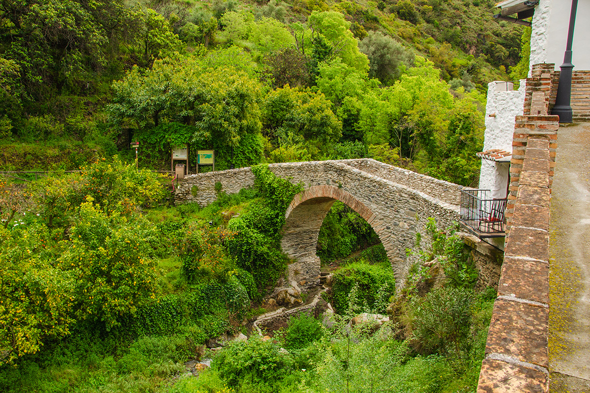
Nearby, an old bridge crosses the Río Salares. Generally associated with the medieval period, it has undergone later repairs and reconstruction. Its position reflects the importance of routes connecting the village with the surrounding countryside. Further east, Canillas de Albaida has another historic stone bridge across the Río Frío, commonly known as the Roman Bridge, although its precise origins are less certain than the name suggests.
These crossings were practical necessities. Rivers descending from Sierra Tejeda cut deeply into the landscape, and reliable bridges made it easier to reach fields, neighbouring villages, and mountain routes. The countryside between the settlements is varied, with stretches of woodland, open hillsides, cultivated terraces and views across the valleys. Much of its interest comes from seeing how closely the villages, their agricultural land and the old pathways fit together.
Cómpeta and the Sierra Almijara
Cómpeta sits among hillsides traditionally associated with vineyards, olive groves and the production of wine and raisins. These crops have a long history in the Axarquía, alongside almonds, figs and other products suited to the Mediterranean climate. Beyond the village, the landscape changes as the cultivated slopes give way to the more rugged Sierra Almijara. Pine forests, rocky ridges and deep valleys replace much of the agricultural countryside. Pale rock and sandy ground give these mountains a distinctive appearance, particularly where light-coloured slopes contrast with the dark green of the woodland.
Although parts of the Sierra Almijara feel remote today, the mountains were once a working landscape. People kept animals, collected firewood and charcoal, cultivated small plots and travelled between scattered farms and settlements. The old Camino de Cómpeta a Granada formed part of this wider network of mountain communications. Remains of farm buildings, agricultural terraces and former stopping places can still be found in parts of the mountains. Walking here brings a different side of the Axarquía into view, away from the larger villages and cultivated hillsides, but still connected to their history.
El Acebuchal and Frigiliana
El Acebuchal, tucked into the hills between Cómpeta and Frigiliana, has a history closely connected with the old mountain routes. The settlement provided a stopping place along routes used by muleteers travelling between Málaga and Granada. Farming, animal husbandry and trades associated with the surrounding mountains supported the small community.
Its more recent history is rather different. Following the Spanish Civil War, El Acebuchal became caught up in the conflict between Franco's authorities and anti-Franco guerrillas operating in the mountains. Its inhabitants were forced to leave in the late 1940s, and the settlement remained abandoned for decades. Restoration began in 1998, and the village's whitewashed houses and narrow streets have since been brought back into use.
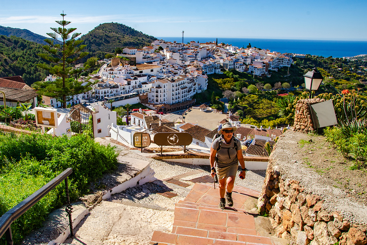
Further towards the coast, Frigiliana has a particularly strong connection with the final centuries of Al-Andalus and the changes that followed the Christian conquest. Its historic quarter retains narrow, winding streets and traditional buildings climbing the hillside above the Río Higuerón. The village's position between the mountains and the coast reflects the importance of both agriculture and communication in the area.
Following the conquest of Granada in 1492, the Muslim population came under Christian rule. Many were later compelled to convert to Christianity and became known as Moriscos. Tensions culminated in the Morisco rebellion of 1568–1571. On 11 June 1569, the hills around Frigiliana were the scene of a major confrontation at the Peñón de Frigiliana. The subsequent suppression of the rebellion and dispersal of the Morisco population brought profound changes to the communities of the Axarquía. Frigiliana's history is an important part of understanding how the region changed after the end of Muslim rule.
From the Mountains to the Mediterranean
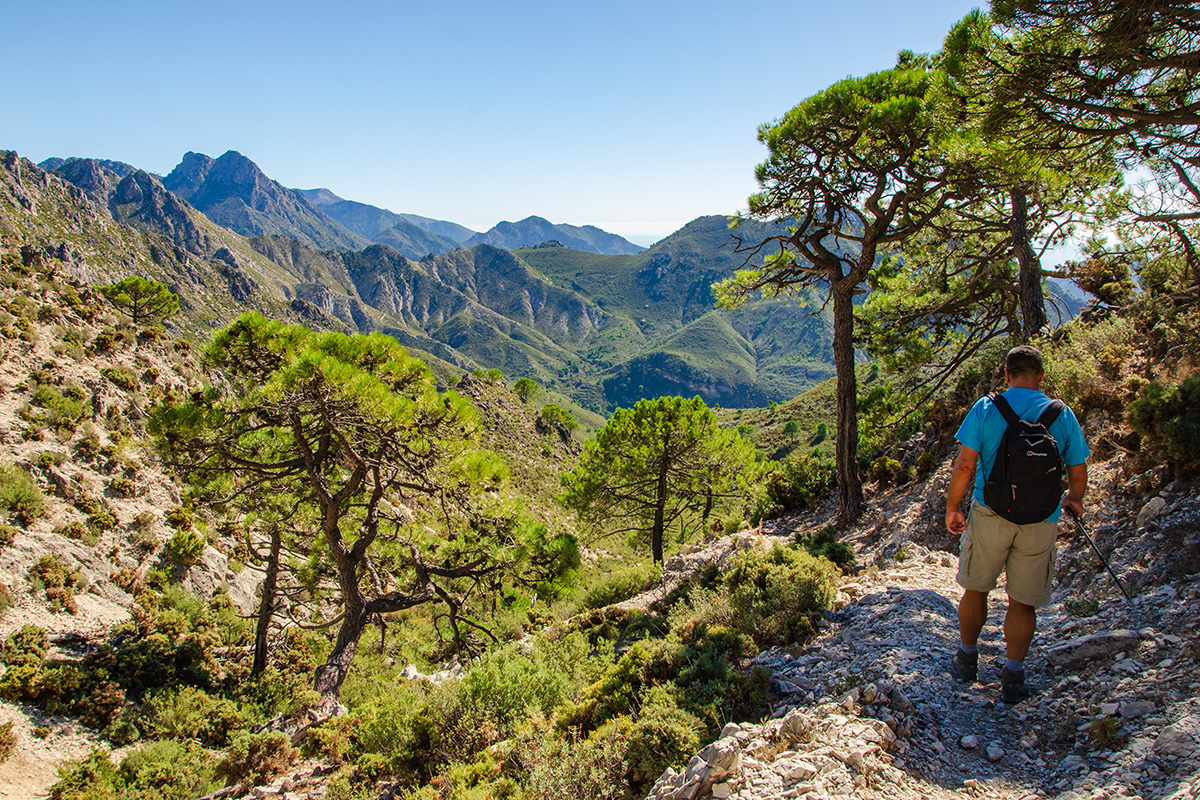
The countryside between Frigiliana and Maro offers another change of scenery, with rocky valleys, wooded hillsides, and cultivated land leading toward the Mediterranean. For centuries, the mountains supplied water to the settlements and agricultural areas below. Routes through the valleys also connected inland communities with the coast, allowing people and goods to move between different parts of the Axarquía.
Today, the villages, terraces, irrigation channels and old pathways still show how closely this landscape was shaped by the people who lived here. Al-Andalus is an important part of that story, but not the only one. The countryside has continued to change through the centuries, with new communities, agricultural practices and ways of travelling leaving their own marks. From Sedella and Salares to Cómpeta, Frigiliana and Maro, the influence of the past is still visible. It gives these three days of walking a historical connection that reaches well beyond the villages themselves.
