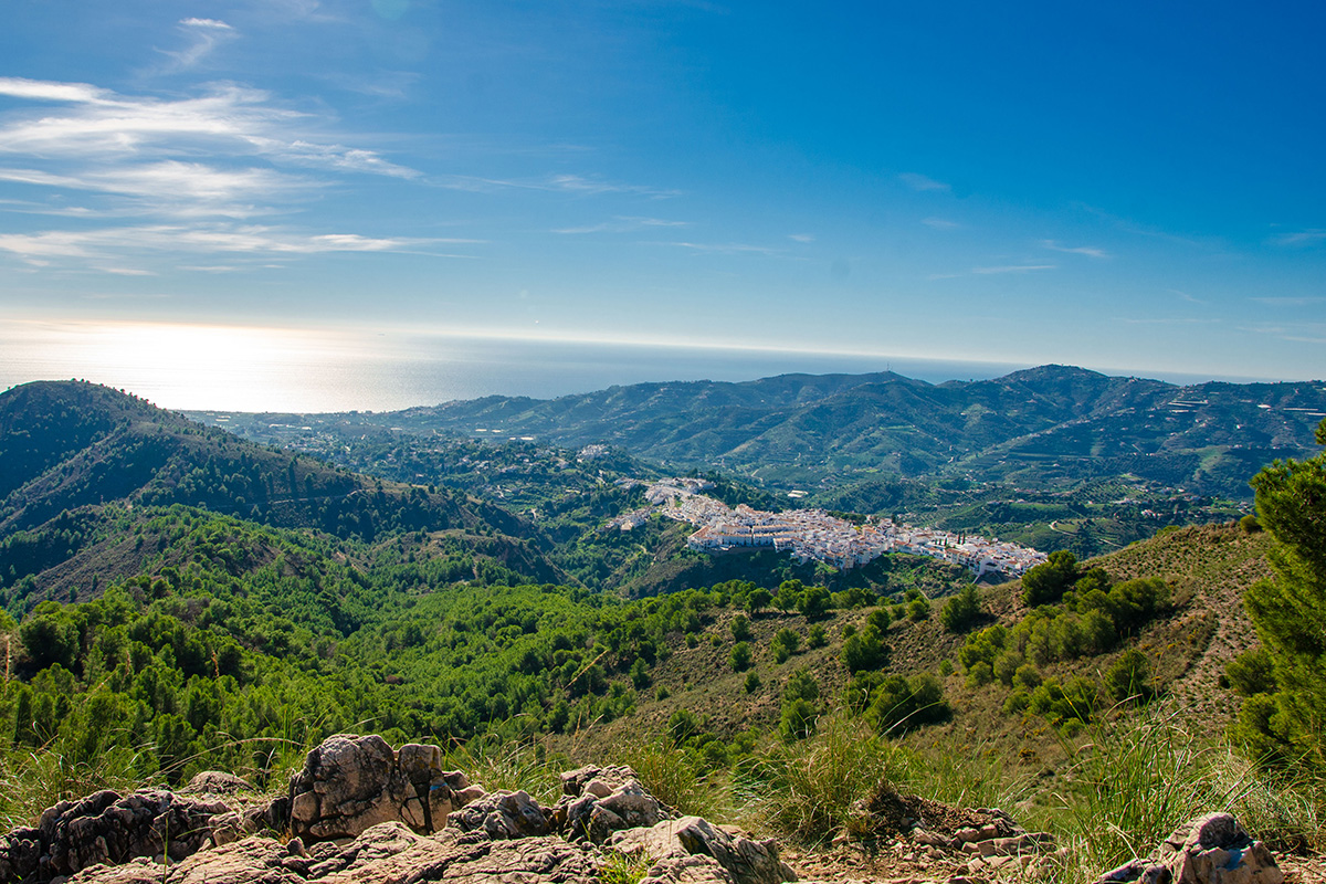
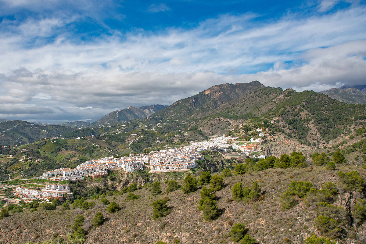
Frigiliana sits only a few kilometres inland from the Mediterranean, but the mountains begin almost immediately behind it. From the old streets and whitewashed houses, the land rises quickly towards the Sierra Almijara, while the Río Higuerón cuts down through the slopes below.
That contrast is what makes this walk so memorable for me. You can begin among the streets, cafés and everyday life of Frigiliana and, within a short distance, find yourself in a landscape that feels far more remote than it really is. The town disappears, the river takes over, pine-covered slopes close in around you and the mountains suddenly feel much bigger.
What makes the area even more interesting is that this relationship between town and mountain is nothing new. People have lived beside the Río Higuerón for thousands of years. Old routes once carried goods and travellers towards the interior, while mountain water was channelled towards Frigiliana and the cultivated land around it. The landscape we walk through today is both natural and deeply shaped by the people who have depended upon it.
A Town at the Edge of the Almijara
Frigiliana's position helps explain why people have been drawn to this landscape for so long. Archaeological evidence from caves beside the Río Higuerón shows that people were living here during the Neolithic, thousands of years before the town we know today began to take shape.
It was during the centuries of Muslim rule that Frigiliana developed more substantially. Its position above the river, with views towards the Mediterranean and access into the mountains behind, offered natural protection while the surrounding land supported agriculture. A fortress, the Castillo de Lízar, once stood on the high ground above the town, while agriculture, including grapes, olives, figs and silk production, became an important part of local life.
That defensive position became particularly significant after the Christian conquest of Granada. In 1569, Moriscos from across the Axarquía gathered on the Peñón above Frigiliana during a rebellion against increasingly restrictive Christian rule. Crown forces eventually attacked and defeated them in one of the defining events in the town's history.
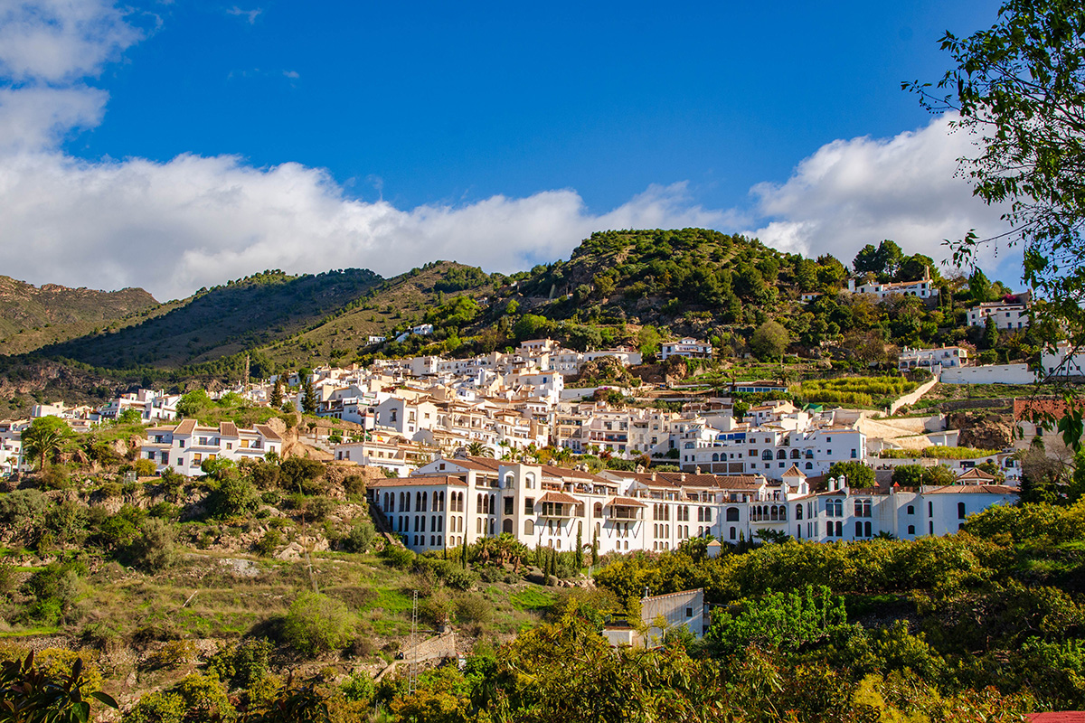
Very little of the old fortress survives today, but standing in Frigiliana and looking towards the mountains, it's not difficult to understand why this particular place mattered. The town sits at a natural meeting point between the Mediterranean coast and the much wilder country of the Almijara, a relationship that has shaped its history for centuries.
Old Routes into the Mountains
The paths leading away from Frigiliana into the Almijara weren't created for walkers. Long before today's waymarked trails, mule tracks connected the town with communities further inland and formed part of a network of routes between the coast and the interior.
One of these old routes headed towards Granada, with muleteers carrying goods through the mountains from the coast and surrounding countryside. Fish and fruit travelled inland, while cereals and other produce made the return journey. Parts of that historic network are still followed by walking routes today, including the GR-249 as it leaves Frigiliana and heads into the Almijara.
I like thinking about that when we leave the town behind. The transition feels remarkably sudden today, but these mountains weren't an empty wilderness separating isolated communities. People knew the paths through them, travelled between settlements and used them to connect the coast with the world beyond the mountains.
Water from the Sierra
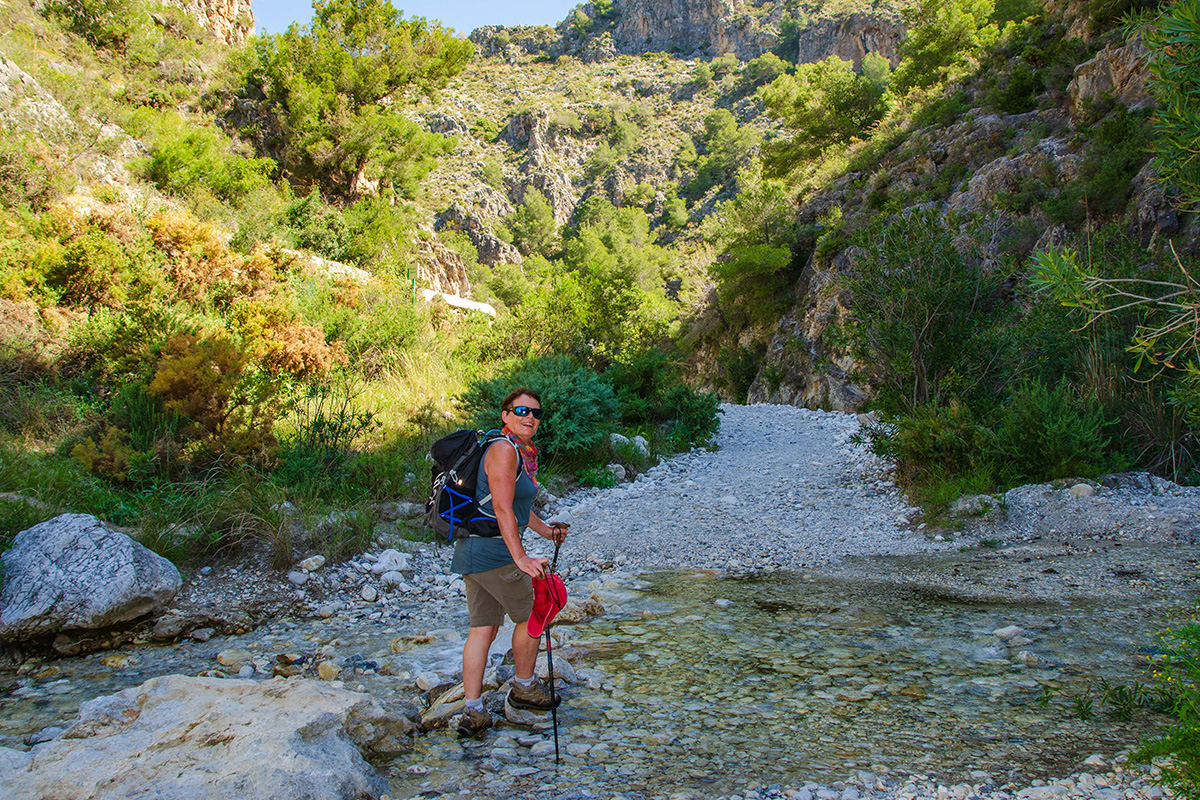
The Río Higuerón is another part of the connection between Frigiliana and the mountains behind it. For much of the year its broad riverbed can appear surprisingly dry, but water flowing down from the Almijara has long been an important resource for the town and the cultivated slopes around it.
Acequias carried that water away from the river and across the hillside towards the land where it was needed. One of the most striking examples is the Acequia de Lízar, which runs high above the Río Higuerón before crossing a series of small aqueducts on its way towards Frigiliana. Lower in the valley, Pozo Batán forms another surviving part of this old water-management landscape.
What I particularly like about seeing these features here is the connection they make between the landscape around us and the town above. The mountains provided the water, the river brought it down from the Sierra, and generations of people found ways of directing it towards their homes and crops. Frigiliana may sit high above the Río Higuerón, but its relationship with the river has always been much closer than it first appears.
Into the Almijara
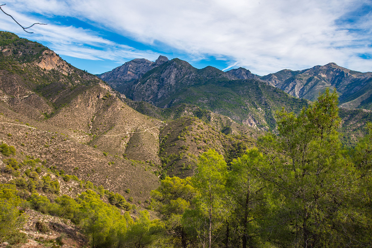
One of the most surprising things about this walk is how quickly the landscape changes. Frigiliana and the Mediterranean are still remarkably close, yet once you're amongst the pine-covered slopes of the Almijara, it can feel as though you've travelled much deeper into the mountains.
That feeling becomes strongest when we reach the ridge above the Río Higuerón. Suddenly the landscape opens around us. Across the valley are the rugged ridges of the Almijara, including those rising above the neighbouring Río Chíllar, while to the south the Mediterranean stretches away beyond the foothills. It's one of those places where the position of Frigiliana between mountain and sea becomes particularly easy to understand.
The landscape changes with the seasons too. In late winter and early spring, I've watched clouds of yellow pollen drift away from the pine forests and across the mountainsides. Against the deep green of the trees, the pale, fractured rock of the Almijara is just as distinctive. But it's the scale of the view that stays with me. We've travelled only a relatively short distance from Frigiliana, yet standing on the ridge, it feels as though we've earned a much bigger mountain landscape.
The Río Higuerón Gorge
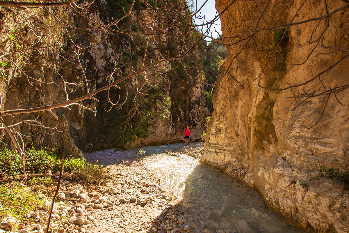
The Río Higuerón has one more surprise. Some sections of the riverbed are broad and open, but for a short stretch south of Frigiliana it narrows dramatically into a gorge, with steep rock walls rising on either side.
The gorge has been shaped by water gradually exploiting fractures and weaknesses in the mountain rock, cutting an increasingly narrow passage through it. Today there may be little or no water flowing through the gorge when we walk there, but the shape of the rock around us is evidence of the much greater forces that have acted on this landscape over time.
It's one of my favourite parts of the walk, partly because it appears so unexpectedly. The gorge is only a few hundred metres long, but the high walls, narrow passage and shade from the trees create a wonderfully enclosed atmosphere. After the expansive views from the ridge, suddenly we're back inside the landscape again.
A Cross Above the Valley
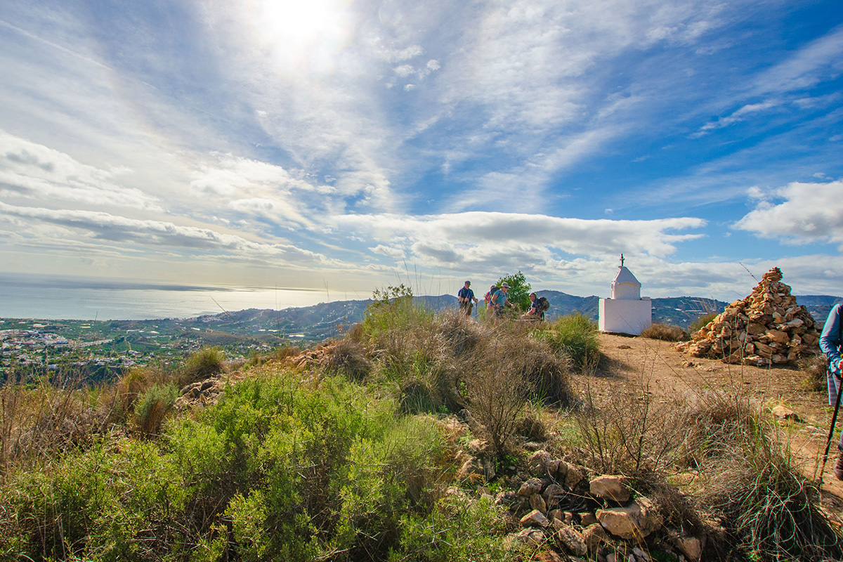
One of the more curious landmarks in the hills above Frigiliana is the Cruz de Pinto, a small white shrine standing on a ridge overlooking the Mediterranean. Its origins are explained by a local legend dating from the 17th century.
According to the legend, a navigator named Francisco de Pinto was caught in a violent storm while sailing towards Cádiz. Fearing that his ships would be lost, he promised that if they survived, he would build a shrine on the first prominent mountain he saw when the weather cleared. The storm passed, the mountains above Frigiliana appeared, and tradition says that the Cruz de Pinto was built in fulfilment of that promise.
Whether the story happened exactly as local tradition tells it is impossible to know, but I rather like the fact that the legend connects the mountains with the sea. From these ridges the Mediterranean seems remarkably close, and a little shrine supposedly built because it was seen from a ship feels entirely at home in this landscape.
More Than the Distance Suggests
What stays with me about this walk is how much the landscape changes within such a short distance. Frigiliana never really feels far away, and yet there are moments amongst the pines and high on the ridge when the town and coast seem part of a completely different world.
Perhaps that's what makes this small corner of the Almijara so interesting. The mountains aren't simply a backdrop to Frigiliana. For thousands of years, they have provided water, protection and places to live and work, while routes through them connected Frigiliana with the interior.
For a relatively short walk, it gives us an extraordinary sense of the relationship between the two. We begin with Frigiliana looking towards the mountains; once we're amongst them, we can look back towards the town and the Mediterranean beyond. It's not the distance we travel that makes the walk feel substantial, but how much the landscape changes around us.